This mount remains in your heart.
The trail to Vårdkallberget (or Värnsberget, as someone started to nickname it) is a well-balanced hike, with only one rugged path along the hilltop leading to the summit at 265m a.s.l.
The name "Vårdkallberget" means "beacon mountain”, and it evokes memories of the old signal fires. In the past centuries, big signal fires in the High Coast Mountains alerted the locals to impending enemy attacks. The beacon chain extended all the way along the coastline so that the armies could be gathered.
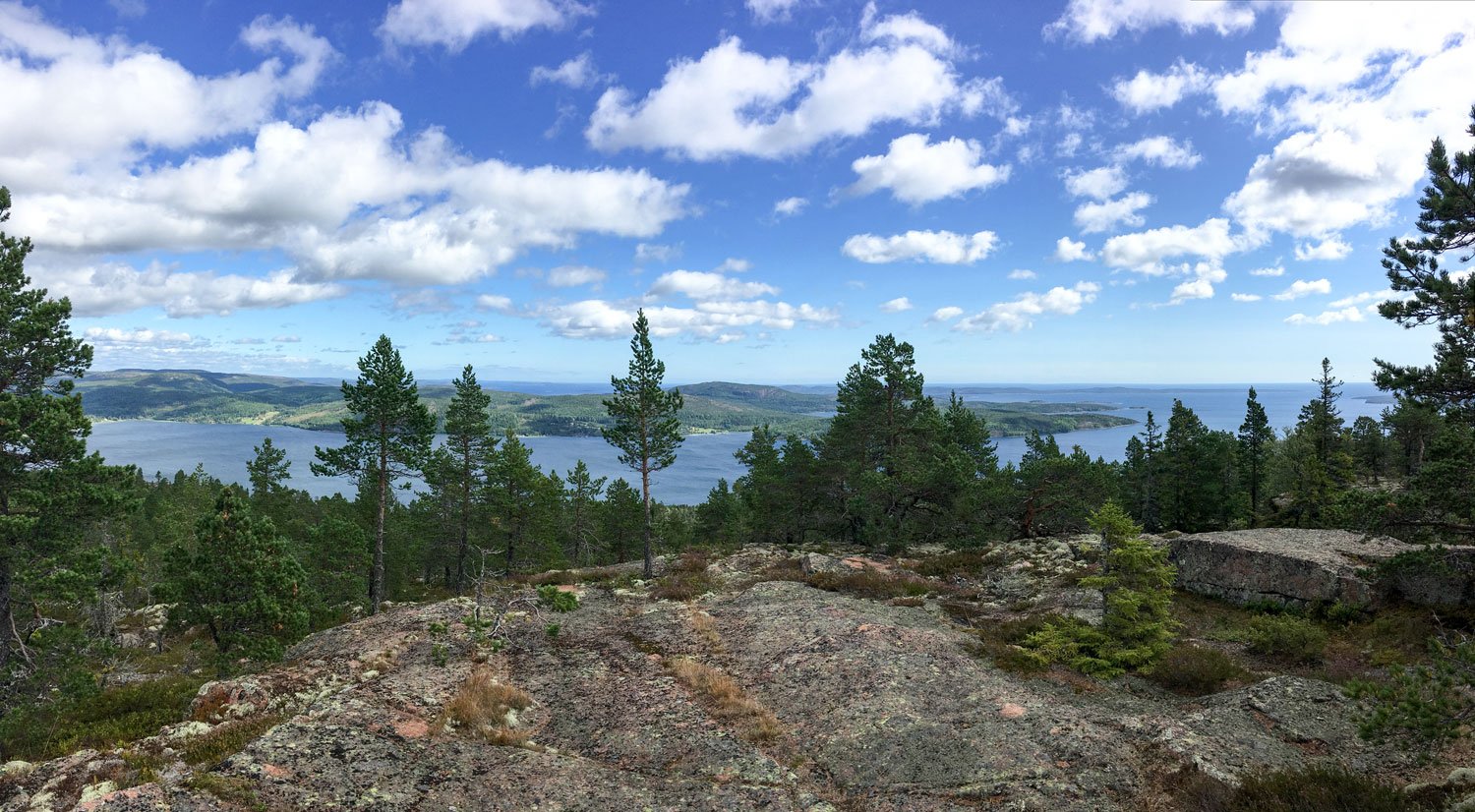
Overview from the summit toward south: on the right, the Fäberget Mount at the entrance of the Docksta fjord.
Rising from the sea, the mountain forms a peninsula, never more than a couple of kilometers wide, that divides the Docksta fjord from the Norrfjärden.
Between the North fjord and the Dockstafjäerden, the peninsula with Vårdkallberget Mount (panoramic view from the summit of Skuleberget)
On the right of the panorama, the summit of the Vårdkallberget Mount from the overview point at Getsvedjeberget.
From the Per Olsbo’s shelter, near the Höga Kusten Leden, view of the Vårdkallberget Mount. From its height, it overlooks the smaller Valabergen Mount, characterizing the shape of the promontory overlooking the fjord “Ullångerfjärden” to the south.
Along the coast, there aren't many houses, and the mountain retain its amazing natural features.
The trail that leads to the top of Vårdkallberget is mostly known by locals and, fortunately, little visited, so it will be much easier to meet some wild animals, though you will probably only see traces of them in the summer.
The Vårdkallberget Mount from the pier at Docksta Havet.
From the village of Docksta, looking south-east, you can see the mountain dominate the landscape at the beginning of the fjord. It is curious to think that it is only thirty meters lower than the top of the most famous Skuleberget.
🧭
Trail to Vårdallberget Mount: back and forward from the Antenna in Myre:
4.6KM, D+180M, ~2HRS
(for hikers of all levels)
From the marina, it's easy to get to the beginning of the path by foot, bicycle, or by parking your car in Myre.
The trail climbs steeply along the short terrain road to the antenna in Myre, then crosses over a short stretch of recently cleared forest before entering the breathtaking wild area. This section of the woods is distinguished by its openness and exposure to the sun.
These particular forested areas, precious to biodiversity for flora and fauna, are called "rocky pine forests". You will understand what it means to cross a natural and undirsturbed old-growth wood in the High Coast.
The rocky pine forests are still dominated by natural dynamics and low human impact since they are considered low productive due to the low tree density (lack of water and rocky and nutrient-poor hilltops may contribute to it).
These are structurally diverse and heterogeneous forests and valuable habitats for organisms connected to sun-exposed dead woods; both snags and logs can be present for several centuries after death.
During your excursion, you will see very old pines (Pinus Sylvestris, particularly) that have been twisted by wind and snow, and you will likely need to climb or surround some storm-fallen trees, whose exposed roots will show you how almost everything here clings to a small layer of soil and to bare bedrock to survive.
At Vårdkallberget Mountain, you get a real taste of what hiking Nordic trails in areas with low human impact looks like
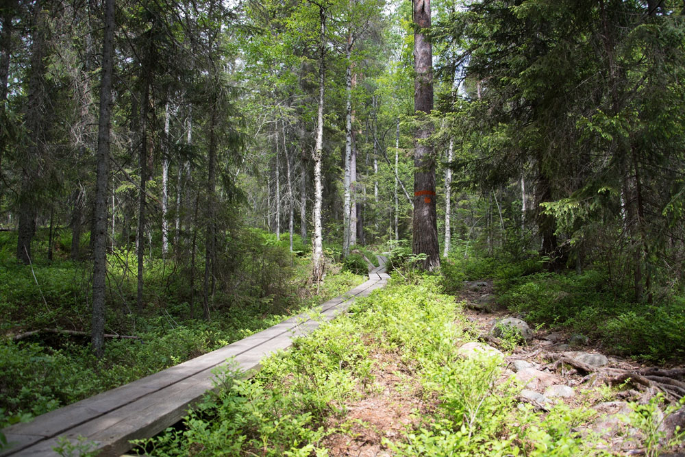
By walking a narrow single track surrounded by blueberry bushes, you will pass portions of thicker forest, passing next to a wet area, and walk a few tens of meters next to a beautiful lake but invisible from the path if you don't start looking for it.
Finding the lake on the map and orienting yourself to get there should be fairly simple if you have a smartphone and a trekking app (like Komoot or Outdoorsctive). Just be cautious when approaching the wet area that is surrounded by a frequently occurring layer of moss under the surface of which there is water.
You will also cross a couple of the typical cobble fields whose pebbles have been rounded by the work of the waves because they were once at sea level around 10.000 years ago.
The final stretch of the trail has sparser vegetation, making it easy to jump over some broad, rocky reliefs of typical red granite that are covered in moss and lichen.
You will be able to identify the southern summit of the mountain by the stacked stones that accentuate some of the 360-degree panoramic points over the archipelago.
If you start exploring the surroundings a little from there, you will discover charming views to the Ullånger’s fjord and, just below the top, on the north side, a particular wind shelter.
Photo ©: courtesy by ArkNat
It's name is “He”, and it was built in 2019 within the ArkNat project by students from different Scandinavian schools of architecture. Because of the shelter's two-sided architecture, guests can tilt the main body for shade, or wind protection, or a gorgeously framed view of the Norrfjärden, toward the Skuleberget and the Skuleskogen National Park.
The whole route to the summit of Vårdkallberget, back and forth from the antenna, is roughly five kilometers long and has a level of difficulty that most people can handle.
Naturally, it is advised to wear a good pair of trekking shoes and a pair of long trousers (the single track path narrows between bushes at certain segments). You won't be disappointed when blueberries are in season, but don't forget to pack a water bottle and possibly some snacks.
When windy, the summit is typically fairly exposed. At Vårdkallberget, however, the sun will shine through the trees for a good chunk of your journey if the weather is good. Have fun!
Tommaso De Rosa
See my host profile and contact me on Airbnb
If you would like assistance planning your stay in one of our waterfront accommodations at the marina, need hiking advice at Skyleskogen Park or Mount Skuleberget, or have any other questions regarding things to do on the High Coast during the summer, please contact me via the Airbnb chat. You are welcome :)
_Tommaso
Please write me by email or WhatsApp at +46.763136909


