Hike at the Skuleberget Mount along the Höga Kusten Stigen

This excursion covers the most breathtaking spots, making it ideal for those who love to explore Skuleberget Mount. You will find described two manageable few-hour walk that will take you to the summit and allow you to visit the Naturum Museum about the High Coast World Heritage site.

They accomplish this by following some of the most well-known pathways inside the unique mountain environment and its natural reserve, enjoying a leisurely stroll around the top, and including the panoramic descent down the Höga Kusten Stigen segment into each itinerary.

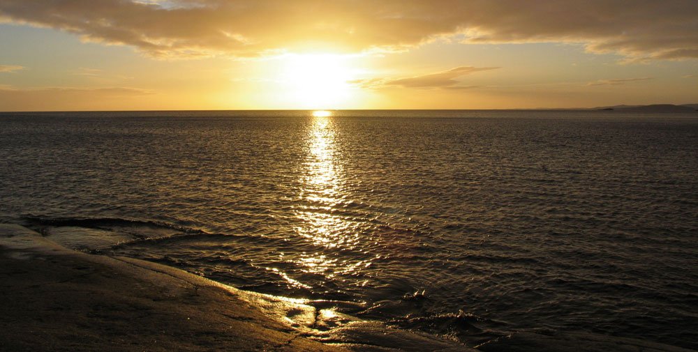
The foot of the mountain can be reached in less than two kilometers from the marina in Docksta.

The paths of the excursion allow you to visit the museum if you so choose, which is located on the eastern side of the mountain (if you go there riding, you can leave the bike at the museum before starting the hike).

Turn right toward the gas station after crossing the bridge heading toward the school, and then continue on the road next to the E4. Continue on the route that retains the mountain to your left after a few hundred meters by staying to the right.

The relief you see from Docksta is the southern portion of the Skuleberget, called the Litoberget (224m a.s.l.). You will pass it on the way back as you descend from the top of the Skuleberget along the Höga Kusten Stigen trail.

To reach the museum by arriving from Docksta, there is a pleasant terrain road between the mountain and the highway, which is less than two kilometers from the end of the village and quite flat.

📍

Naturum is where you begin your journey to the summit.

About Naturum

The museum was built in 2007 right under the vertical walls on the eastern side of Skuleberget. Here are also the 5 slopes on the equipped wall of “Via Ferrata”, which attracts climbing enthusiasts from all over Europe.

The Naturum Höga Kusten Museum serves as the starting point for anybody interested in learning more about the history of the High Coast and the network of nature heritage sites that crisscross the coast. The elevation of the terrain served as the rationale for the site's designation as a World Heritage Site. There are always both temporary and permanent exhibitions, along with additional events throughout the spring and summer. With unique information bars that provide visitors with information on the many themes, the show, which looks at land uplift, geology, and living on the High Coast, adopts a contemporary and lighthearted approach.


Reaching the top of the Skuleberget is an enjoyable excursion, and it is within reach of everyone. Simply appreciate the pathways and ascend in a relaxed manner. There are plenty of indicators, and the paths are clearly marked.


What’s the recommended route?

👇

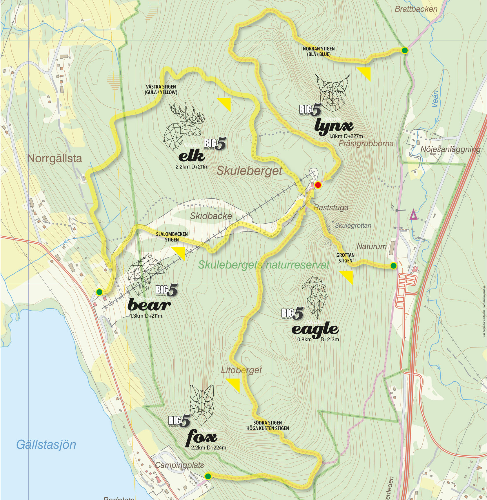
Hike the “Eagle” path or the “Lynx” path uphill to the summit of Skuleberget and then follow the “Höga Kusten Stigen” path to return down.

I suggest you have two options of routes to climb: the first (in GREEN on my map), along the path that leads right next to the museum. The second (in LIGHT BLUE) slides from the east side to the north side of the mountain, offering panoramic views and really fascinating areas in the forest.

The difference in altitude on these pathways is less than 300 meters (EAGLE segment D+213m; LYNX segment D+227m), but you don't have to think of the experience as a straightforward stroll. The Skuleberget has all the characteristics of a mountain, despite its height, which should lead us to classify it as a hill. Even the most seasoned hikers should give their paths due thought and respect.


Option #A:

up along the EAGLE segment

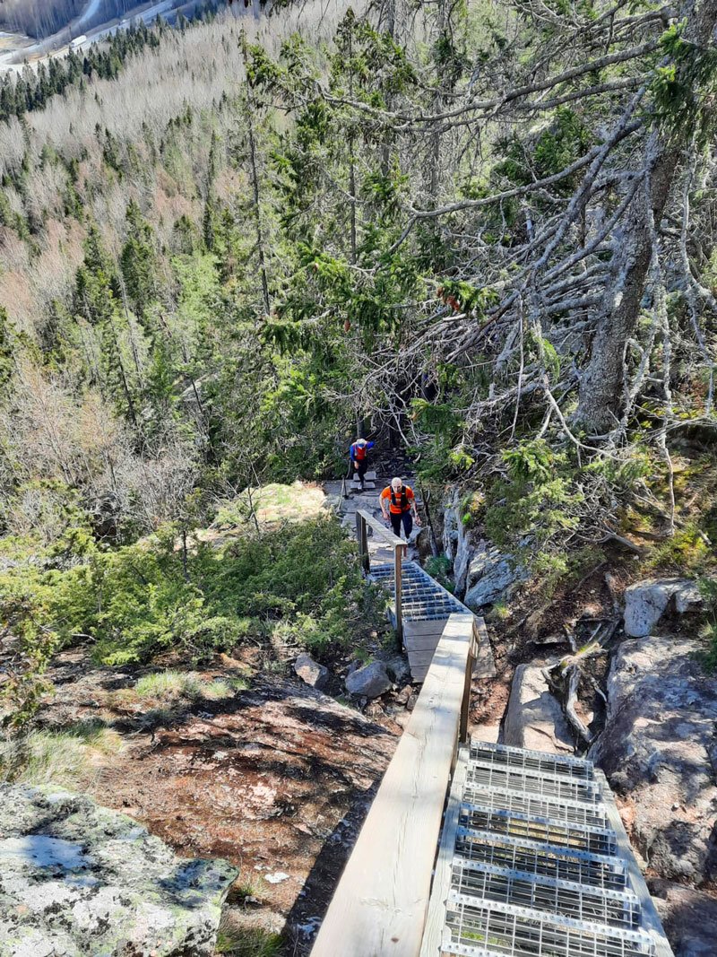
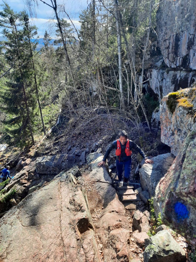
This steep trail takes you to the summit in a little more than 800 m, overcoming almost 250m of dislevels along a rather vertical route that also leads, with a short indicated deviation, to visit the cave.

The cave is known as Kungsgrottan or Rövar Grottan, is a round cave formed from erosion by sea waves thousands years ago.

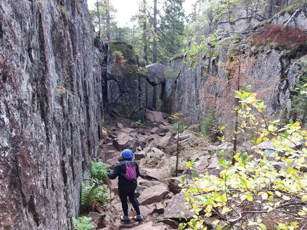
This path is indicated on the sign as “Grottsstigen”. Mountain riding enthusiasts have nicknamed it “Eagle”, and it is one of the most challenging segments of the five trails that lead to the summit.

You won't have really “to climb” along this path, but you will need appropriate footwear and a little climbing attitude! You will walk on stones, rocks, and roots; some points are challenging but absolutely safe; and with iron steps, you will run to overcome the most vertical sections.

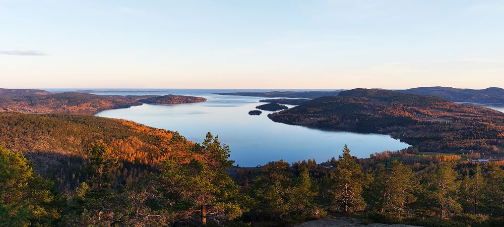
The stunning scenery, which includes the national park to the west and the Norrfjärden and archipelago to the east, will make the effort well worth it. You'll be glad you made the journey when you reach the peak.

A couple of tips related to the EAGLE segment 👉 when it's raining or the ground is wet, take an alternate path to ascend instead of facing down the Grottanstigen. This is not the road for your dog if he is with you.


Option #B:

up along the LYNX segment

The second track climbs to the top following the “Blå stigen / Östra bergsstigen” trail. You can catch it by continuing from the museum to the north along the route of the Höga Kusten Leden in just over 800 meters. On the left, after the paths leading to the trails of the Via Ferrata, starts the “LYNX” segment, which on the signs you will see indicated as Stigen/Norra Stigen.

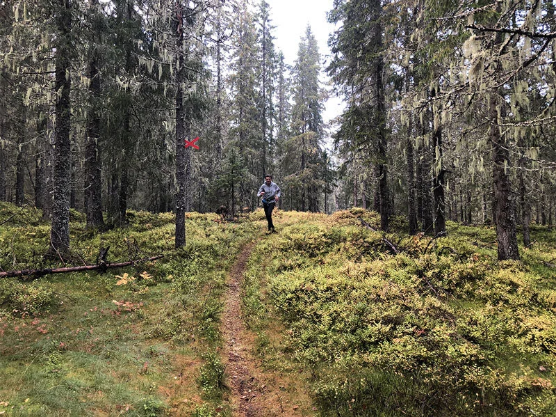
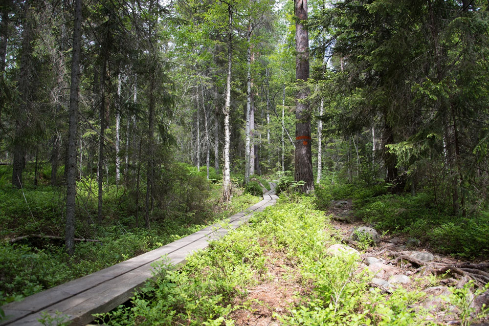
It is a beautiful route and probably the most suggestive to walk. You can see, especially in the first part, the high vertical walls on the side of the railway roads, which fall into the most impervious forest of the trail, and the characteristic subforest of these woods, with moss on the rocks, the roots appearing, and the remains of tree trunks.

A tip related to the LYNX segment 👉 in the warmer summer days (sometimes they are damp even at these latitudes), this is the route to climb that offers the most cooling. In the morning, in particular, this is the side of the mountain to choose, and then descend instead from the side exposed to the south, which is super-panoramic and sunny.


📍

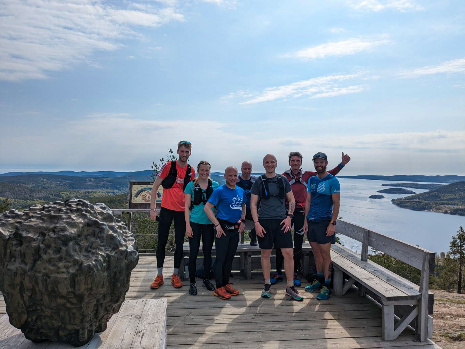
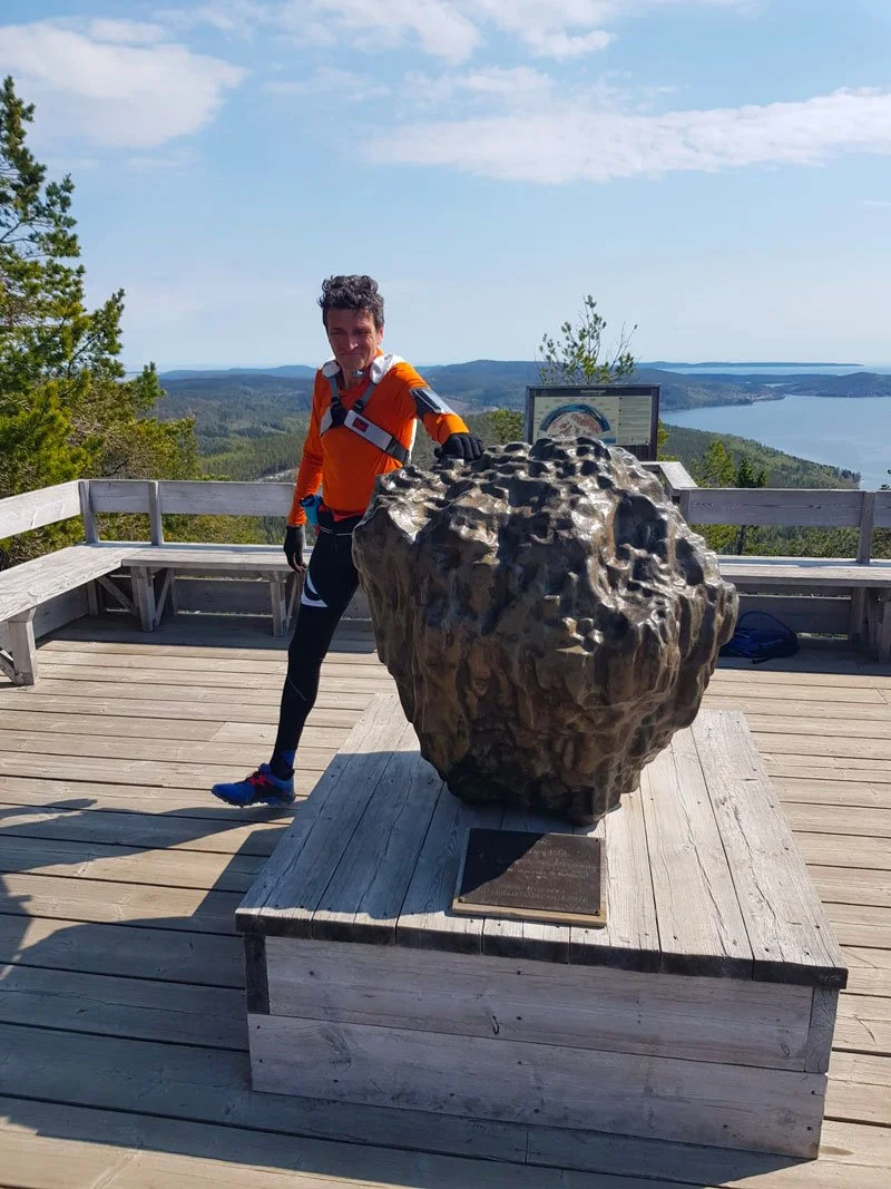
Finally, you are on top.

Right next to the Toppstugan, there is a panoramic wooden platform where you can find the bronze sculpture “Skrubban” by Hans Hedberg, a tribute to the small island of the same name that lies south of Trysunda and to the Höga Kusten UNESCO heritage. At the end of the climb, it is tradition to pass by the Skrubban and touch it.

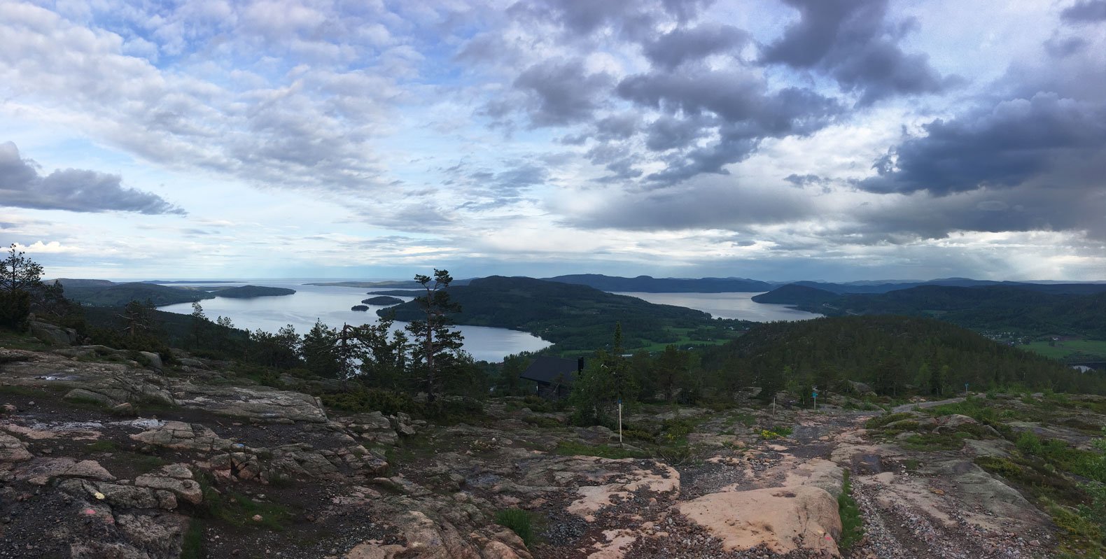
You are about 286m above sea level, at a height that ideally outlines what more or less 10,000 years ago was the coastline of a small, nine-meters-high island (the peak of the Skuleberget, that's now is 295 meters above the sea level) that emerged from the surface of the sea, completely surrounded by ice during the last glacial period.

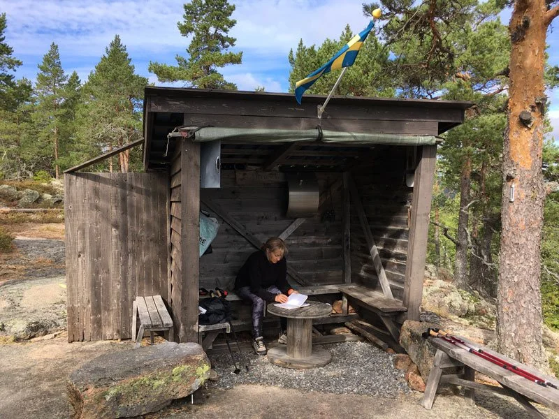
Today, there is a path marked with red signs on rocks and trees that runs on this hill on a circular path around the summit of Skuleberget. The “Kalottstigen” is a fairly flat walk, a little more than a kilometer long, offering unforgettable panoramic views. I suggest you take this trail; maybe stop for a break with your breakfast in the bag before starting the return route.


A panoramic route back:

Go down the Höga Kusten Stigen trail enjoying the sea views.

The sunny path with views of the sea, called “Höga Kusten Stigen”, was opened in 2017 on the south-facing side of Skuleberget to welcome new hikers to the world's highest shoreline at 295 meters above sea level, connecting Friluftbyn to the summit of the mount.

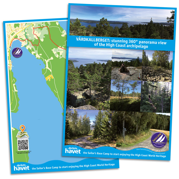
It is a very panoramic trail (in BLUE on the map) that offers views of the two fjords, Norrfjärden and Dockstafjärden, and the main mountains that divert the area: Getsvedjeberget to the East, the Vårdkallberget peninsula (🧭S-E), the particular duck form of Fäberget (🧭S), where the Ullångersfjärden is forced, and Herrestaberget westward (visible from the top of the Skuleberget, on the opposite side of the Gällstsjön lake).

The path begins a hundred meters from Toppstugan, on the left, at the beginning of the ski slopes. You'll see the signs indicating it. It slides down on the southern slope, along a forested crinale that reconnects to Litoberget, and then turns a little east, opening up towards the beautiful view of the fjords and Docksta.

The Södra Stigen continues to descend steeper along endless red granite walls, down to the valley before twisting. On the left, you return to the woods towards the museum; on the right, you turn around the mountainside and descend to Friluftbyn.

Ah! Walking the Höga Kusten Stigen, you descended from the segment nicknamed "FOX,", another of the five paths, along with BEAR and ELK, of the Skuleberget Mountain.

Whatever route you choose to ascend Skuleberget, I'm sure the trail will be etched in the memories you carry from Höga Kusten. I am familiar with all of this mountain's pathways; each has a unique personality and the capacity to evoke strong feelings and memories in you.

🔎 LYNX, EAGLE, FOX, ELK, and BEAR: know more about the five paths that brings you to the summit of Skuleberget Mount >


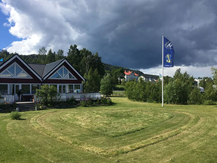
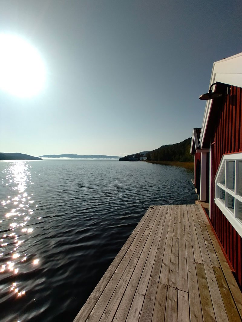
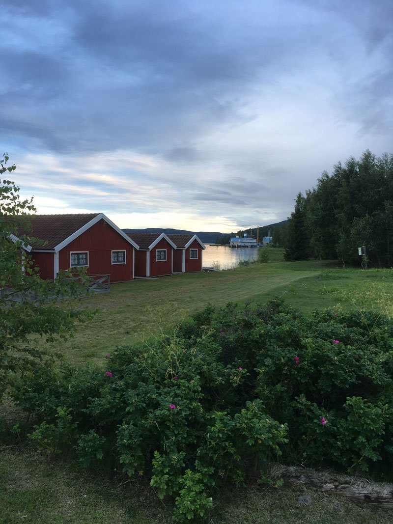
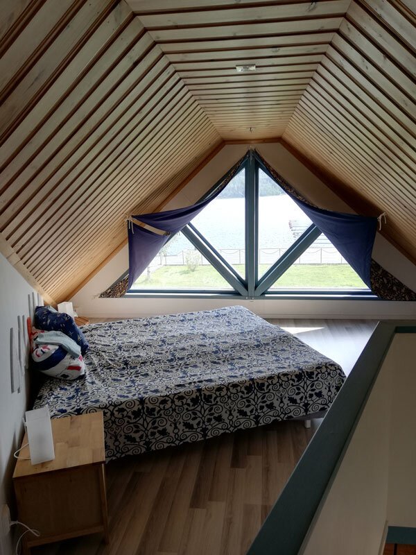
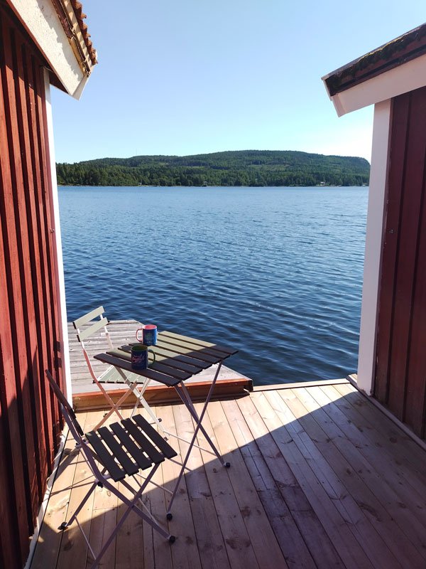
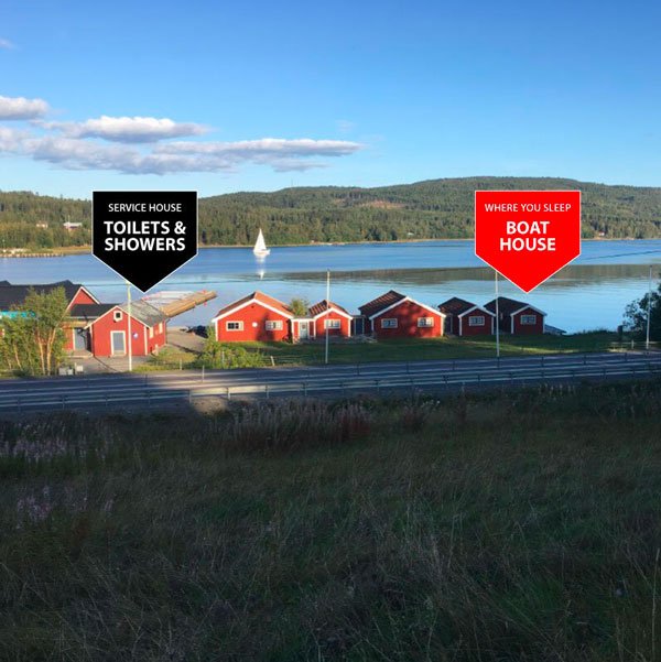
SET YOUR #HIKING BASE CAMP TO EXPLORE THE HÖGA KUSTEN WORLD HERITAGE SITE:

📍

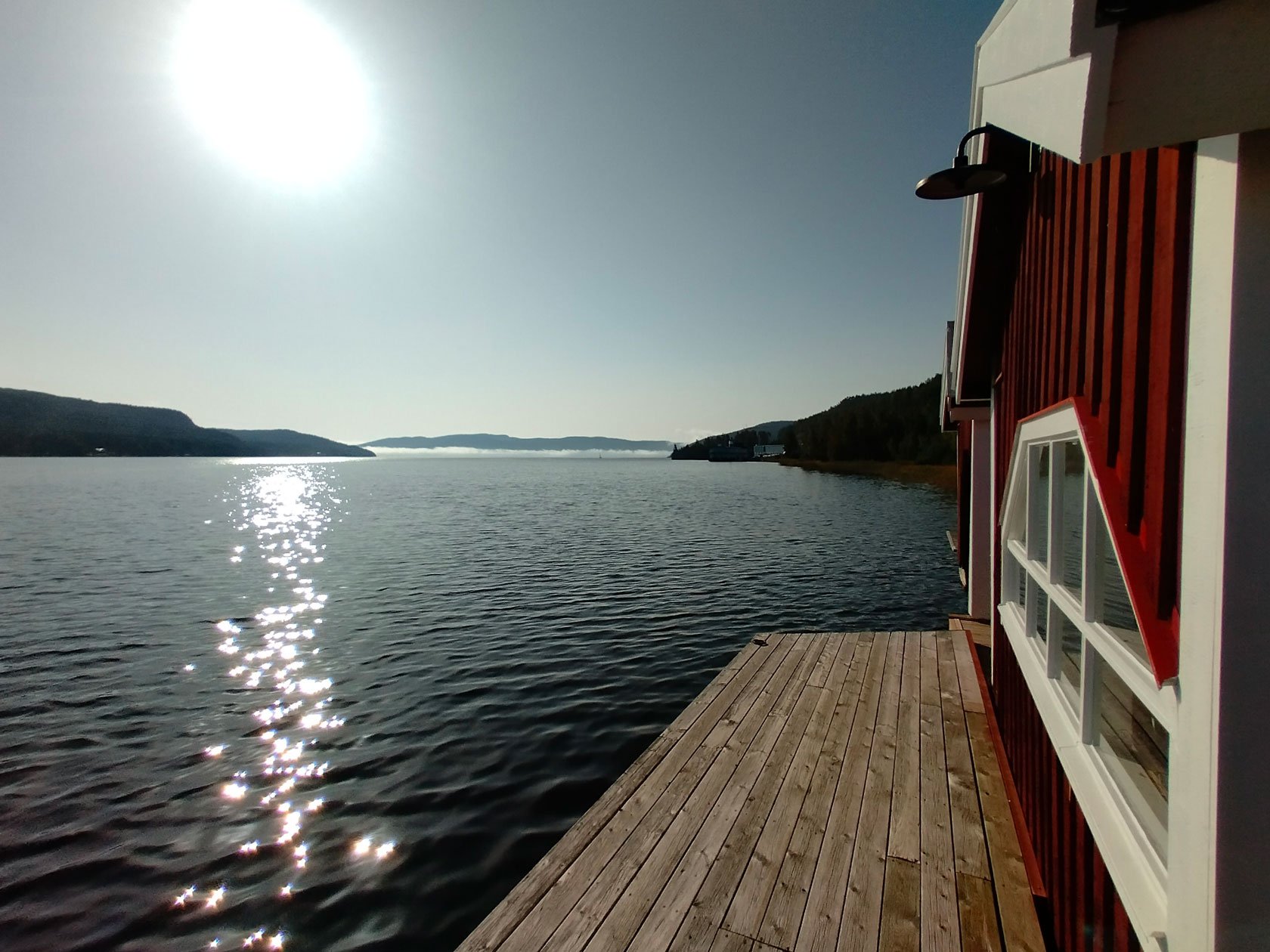
These waterfront Airbnbs are situated just a step away from the Skuleberget Mount and close to Skuleskogen National Park.

Based in Docksta for your vacation, you can walk to the trails that lead you to the summit of Skuleberget Mount that I have described, and you will be close to the national park Skuleskogen. You can also easily get around by car or by bus, and you will be in the ideal location to start exploring the area. 👉 Take a look at our vacation Airbnb accommodations by the seaside >


Tommaso De Rosa

See my host profile and contact me on Airbnb

If you would like assistance planning your stay in one of our waterfront accommodations at the marina, need hiking advice at Skyleskogen Park or Mount Skuleberget, or have any other questions regarding things to do on the High Coast during the summer, please contact me via the Airbnb chat. You are welcome :)

_Tommaso

Please write me by email or WhatsApp at +46.763136909


P.S. I’m a trail runner passionate. I like to explore new routes with a hiking mindset, especially those on the High Coast. Here below you find what I highlighted in these blog posts.

👇

4 links to get the best spot in paradise for trail-running Höga Kusten

Read this post if you love running or hiking, and save its links for your next Höga Kusten holiday in nature.

Get practical information on hiking and trail running routes on the paths in the forests of the beautiful mountains surrounding the area of Skule, their summits give exciting panoramic views of the archipelago.

Even if you are only visiting the High Coast for a few days, there are at least six mountains in the area that will provide you with unforgettable hikes, and at least two of them you simply must run: the trails at Skuleberget Mount are located a mere few kilometers away from our piers, whereas Slåttalsberget summit is situated inside Skuleskogen National Park.

Catch the opportunity to run across beautiful forests between the mountain and the Baltic Sea and to get unique "trail" experiences reconnecting the wilderness.

For a few unforgettable outdoor missions into nature during the weekend or for a several-day holiday plan, you can draw your adventure over the breathtaking scenery of the High Coast: set your base camp in Docksta, starting from the marina and exploring new trails and terrains right into the heart of World Heritage.


4 key links to start from: explore endless opportunities for trail runners and hikers in the area of Skuleskogen National Park or Skuleberget Mount nearby Docksta.

The High Coast is a paradise for trail running: it offers the perfect terrain playground for hikers and runners, both for beginners and experts.

Plan ahead of time, get your calendar ready, and organize your runner's holiday, and don't forget to include these locations and best segments:


1#

Run the Skuleberget Mount's magnificent paths into its natural area

5 trails highlighted by local runners 👉 read more >


2#

Slåttdalsberget Mount: don't miss a memorable trail to experience the Skuleskogen National Park's top spots and scenery

I wholeheartedly endorse this trek 👉 read more >


3#

Discover the paths to the most stunning panoramic spots over the archipelago: Vårdkallberget, Getsvedjeberget, Fäberget

Run steep, get high on the High Coast 👉 read more >


4#

And if you want to add some adrenaline competition to spice up your vacation, joining a race is a top opportunity to discover new special places to run and to meet people who share your same passion.

Here is the reasonate calendar of trail running events and races on the High Coast: from the autumn or winter edition of the Höga Kusten Trail, to the TrailÖvik or HärnöTrail races, and others appointments.

Run wild, race fast in the Höga Kusten 👉 read more→


I attempted to provide a brief overview of some of the countless options for hiking and running in the outdoors during a trip to the High Coast, even if it's just for a few days, by writing the blog posts that are highlighted at the links above.

From a natural perspective, this part of Sweden is beautiful and has many distinctive features. The Höga Kusten can provide visitors who wish to run or hike with an amazing experience in the forests, islands, mountains, and coastline that define the archipelago, as well as those who just want to relax and enjoy a stay that immerses them in Nordic nature.

Looking for an unusual trail-running experience in the High Coast? 👉 Try this excursion along Rotsidan >


The High Coast in Västernorrland County, Sweden, is also a world heritage site for trail-running enthusiasts!

Set your holiday base camp at a top location.

Based in Docksta for your vacation, you can walk to the trails that lead you to the mountains that I have described, and you will be close to the national park. You can also easily get around by car or by bus, and you will be in the ideal location to start exploring the area. 👉 Take a look at our vacation Airbnb accommodations by the seaside >


#HIGHCOASTRUNNER

”I’m sharing running experiences within the High Coast World Heritage in Sweden”

Feel free to contact me:

Tommaso De Rosa

@tominthehighcoast

+46 (0)76.3136909

or +39.335.1309207 (WhatsApp too)
dockstahavet@gmail.com


P.S. I like to explore new routes with a hiking mindset, especially those on the High Coast. Here below you find what I highlighted in these blog posts.

👇

Walk in the forest to the “magic” wind shelter of Per-Olsbo

The shelter was built by Per Olsbo in 1997; he dedicated and opened it to any hiker passing through this beautiful part of the High Coast World Heritage site. It is unique and a really magical place!

Starting from the piers of the marina, the walk to South to Skovedsberget brings you to an amazing viewpoint over the Dockstafjärden.

From the old church at Vibyggerå, the Höga Kusten Leden's path heads into the fields of the countryside and into the forest. It's an easy walk that everybody can approach, but it's 100% hiking into nature!

(👉 Don't forget to take with you a Swedish "fika.")

WALKING: 40 min
TOTAL DISTANCE: 3,8 km

  • Docksta Havet Base Camp -> Old Church 2 km

  • Old Church -> Skovedsberget utsiktsplats 1,8 km


FREE DOWNLOAD:

INFO-MAP for your excursion to Per-Olsbo wind shelter >

(.pdf - 4MB)

Hike at the feet of SKOVEDSBERGET Mount:

Short walk in the forest to a magic shelter over the Dockstafjärden

During your stay at Docksta, take a moment to take a walk there :)

At the end of the main road of the village, take the upward road (Prästbacken) that leads to Sätra.

The ancient church you meet where the path begins, the old church of Vibyggerå, was probably built in the late 1200s or early 1300s.

After the new church of Docksta was completed in 1874, at Herresta, the Vibyggerå old church was abandoned until 1916. The new church was then burned down by lightning and the old one had to be restored to worship use again.

The interior is decorated with beautiful frescoes from the 17th century. The altar dates from 1771. The pulpit was made in 1740 and triumph crucifix dates from the Middle Ages. (Source: Wikipedia)

From the church, the trail crosses the meadows and feed fields before entering the woods after a few hundred meters.

You are on the Höga Kusten Leden trail, southward. The path to the shelter rises gradually; it is a pleasant walk. After a little more than one and a half kilometers, there is an outlook that leads to the panoramic point (utsiktsplats) where the shelter was built.

Per's shelter is different from any other you'll encounter on your excursions. It is a special place, and it is understood that it is there to make the stop as pleasant and comfortable as possible for the passersby.

It is well equipped; you will find everything you need to prepare a falò safely, and much more will surprise you, such as the binoculars and the guest book.

Above all, you will adore this unique nook that feels like it belongs to you and touches your heart, even more than the view! That is gorgeous over the Dockstafjärden to the south-east and Vårdkallberget Mount, and toward the north, over Docksta and Skuleberget.

Usually, I go to the wind shelter running from the marina (this route has a couple of funny Strava segments), but walking will really make you enjoy it. The sun rising directly in front of Skovedberget in the morning adds a unique light and ambiance to this spot.

See Utsiktsplats Per-Olsbo on naturkartan.se >


P.S. I’m a trail runner. I like to explore new routes with a hiking mindset. Here you find what I highlighted to explore the High Coast Worls Heritage Site >

Feel free to contact me:

Tommaso De Rosa

Instagram: @tominthehighcoast

+46 (0)76.3136909 or +39.335.1309207 (WhatsApp too)

e-mail: dockstahavet@gmail.com

See my host profile and contact me on Airbnb

Just below, you can read about our holiday Airbnb accommodations by the seaside in Docksta: starting from the piers of the marina, you will be in the ideal location to enjoy the area, the national park Skuleskogen and the trails at Skuleberget Mount (plus, the other summits that surround Docksta).

How to get to Docksta, Höga Kusten, by flying to Sweden at Stockholm

🛬🇸🇪

You land at Stockholm International Airport Arlanda, which is roughly 40 minutes from the downtown center of the capital. You can go to Höga Kusten from there in at least four ways: by car, by train, by bus, or by air.

Docksta is located in the north of the country, about 500 km from Stockholm. The village, in the heart of the High Coast World Heritage Site, is crossed by the main north-south connecting route, the E4.

Docksta is very well connected to the buses that run north-south the coast of the country. Long-distance buses reach the capital at Stockholm City Terminal or the Arlanda Airport, and regional bus connections make it convenient to reach the cities that are on your public transport route: they are Sundsvall and Härnösand (you get there by train from Stockholm), or Örnsköldsvik if you arrive from the north.

In the village, there are two stops for these buses, "Docksta Marina" 50 metres from us, and "Docksta Busstation" right next to the ICA supermarket a few hundred meters from the marina.


How to get to Docksta?

You just have to choose:

1# 🚍

Docksta can be reached by bus departing from Arlanda (or from Stockholm City Terminal), the journey takes over 6 hours. If it fits your travel times, the bus can be cheap, there's usually free wifi, and best of all, you don't have to drive—just unwind and take in the scenery (much like on the train).

Find more at www.ybuss.se


2# 🚄+🚍

From the airport at Arlanda, you can also go straight by train to Sundsvall or Härnösand, from where you can continue by bus, which leaves from the destination railway stations. Buses take you to Docksta, the stops at are just a short distance from the marina.

In example: Arlanda Central Station 🚄 -> Härnösand station 🚍 -> Docksta busstation

TIP 👉 To ensure that the bus service is truly available on the day of your choosing, check and make your reservation in advance.

Find more at: www.sj.se (search your journey from “Arlanda C” to “Docksta”)


3# ✈️+🚍*or🚙**

When you land at Arlanda (ARN) on an International flight, you can reach the airport area where domestic flights depart: there are sixty-minute flights with SAS to "Midlanda” (Sundsvall/Härnösand Airport), alternatively, you can look up flights with SAS to Örnsköldsvik.

* From the airports you have to take a taxi to reach the bus terminals. The bus will take you to Docksta. Make your reservation of the bus in advance and confirm that the service is actually available on the day of your choice.

** Alternatively you can rent a car. Distances from the airports: Midlanda (SDL) -> Docksta: 98Km; Örnsköldsvik (OER) -> Docksta 61Km

Find more at: www.sas.se


4# 🚙

In Arlanda, you can also rent a car and drive to the High Coast on the highway (E4). The drive from the south to the north—through forests mostly—is a pleasant trip in and of itself. 462 km to arrive in Docksta from the airport; simply follow the E4 to the north (with direction North -> Sundsvall/Haparanda).

See also, car rental at Arlanda airport, Stockholm (by economybookings.com)

This latter case is particularly an option to think about if you're not a solo traveler. If you are traveling with other people, renting a car together can make it easier and more convenient for you to get around and explore freely on the High Coast.

The area of Höga Kusten is very large; only its coastal portion expands across a distance of around 100 kilometers to the north and south. There are many of locations that you will like to visit, but unless the purpose of your holiday is to go trekking—a beautiful mode in this natural setting—you will value having a car available for your trips.

🚙 In the north of the country, tähe traffic is generally minimal. You will be able to take in the breathtaking scenery of Sweden, which includes huge forests and dazzling lakes. Particularly in more isolated places, keep an eye out for wildlife when driving. 


TIP 👉 Moving to Sweden during the summer holidays in particular requires careful planning of your travel. Whether it’s flights, train tickets, or buses for the main destinations, remember to make all reservations in advance, in any case, before you start your trip.

TIP 👉 Pay attention, on public holidays and on Saturdays in particular, to the actual availability of public transport services (especially buses); routes and schedules are often reduced: to be sure, book and buy your tickets in advance :)


Do you know how to get to the marina when you arrive in Docksta?

This is our address:

👇

Docksta Havet AB - Hamnen, 10 - 87396 Docksta

It's simple because we are on the seaside right in Docksta, about 100 meters from the pier of the ferry to Ulvön Island and the bus stop "Docksta Marina".

When you arrive in Docksta on the E4, just at the end of the Dockstafjärden in front of the village, you will see our floating wharfs, the docks and boathouses, and the main red building with light blue signs (with www.dockstahavet.se) on its roof.


I hope that this blog article was helpful for you. I looked at the many ways to go to and from Docksta and Arlanda International Airport, so you can make an informed decision based on your timetable and budget to travel to the High Coast during your holiday.


Rent one of these unique vacation rentals to maximize your trip to the High Coast:

Located near the Skuleskogen National Park and the Skuleberget Mount, these seafront Airbnbs are situated at the Docksta marina. The coastal lodgings are in an ideal location for exploring the Höga Kusten World Heritage site.


Tommaso De Rosa

See my host profile and contact me on Airbnb

If you would like assistance planning your stay in one of our waterfront accommodations at the marina, need hiking advice at Skyleskogen Park or Mount Skuleberget, or have any other questions regarding things to do on the High Coast during the summer, please contact me via the Airbnb chat. You are welcome :)

_Tommaso

Please write me by email or WhatsApp at +46.763136909

P.S. I’m a trail runner. I like to explore new routes with a hiking mindset, especially those on the High Coast. Here below you find what I highlighted in these blog posts.

👇

Basic tips to get ready for your day hike (or run) on High Coast paths

The great outdoors is calling: a walk's quality need not be determined by its duration or level of difficulty, nor does it have to be an intense hike.

Being on the High Coast represents an opportunity to move in nature in an unparalleled way.

It's a good idea to keep in mind a few recommendations to ensure the success of any excursion you have planned that may be completed in four or five hours, even if it's only a few kilometers on paper.


6 suggestions to prepare you for your outdoor walks on the Höga Kusten

1. You need suitable footwear. With few exceptions, all the paths that lead you to climb or descend on the reliefs are very technical, you will also walk on rocks, roots and pebbles. You do not need heavy or rigid shoes, good shoes are enough, for example for hiking or trail running, that are comfortable, with a good grip and possibly tasselled.

2. Move with a light backpack, always carry a reservoir of water with you and something to eat to replenish your energies. Remember that you won't be able to easily access stores to "supply" or just stop for a drink when you're in the woods or on the national park's trails.

3. Check the weather forecast, bringing appropriate clothing (to stay warm and dry, particularly).

The applications YR.no and SMHI.se are excellent for puntual locality forecasting.

4. Plan your route. The paths within the national park or protected natural areas, and the Höga Kusten Leden are average well marked, you will generally find signs with the indications that are needed or more easily than signs made with colored paint on rocks and trees.

Taking a look at a map, to know the territory where you are moving, is always a good idea. Tourist information points can in most cases provide you with a useful one.

👉 You can find many maps even downloadable online, (below, you can free download our info-maps, too), or use apps (like Kamoot, Outdoorsactive...), when you have network coverage. A good resource are naturkartan.se website and app.

👉 Have a look also at our outdoor MAP-POSTERS >

If you're adventuring on trails that you don't think are popular, let someone know about your route and your excursion plans.

5. Bring a cell phone with the batteries charged but remember that you will not always have the coverage guaranteed, especially if you are in roaming with a non-Swedish telephone contract.

6. Carrying hiking or Nordic walking poles in your backpack could be an excellent alternative if they are foldable. Although they are helpful equipment, many of the rough and rooty pathways you may come upon are not suitable for them.


Little etiquette guidelines

Additionally, you will find here a few basic etiquette rules for a more environmentally conscious outdoor experience.

📍Keep it wild.

Just remember that the natural environment you are moving into is unique and delicate.

Stay on the existing paths (do not venture off the trails creating new ones or cutting switchbacks). Remain on it to avoid harming the natural spaces around it. With so many visitors enjoying natural areas for their outdoor recreational activities, a simple shortcut through a dune, around a wet trail, or across a meadow can have long-lasting negative impacts.

📍Do not disturb wildlife.

Your surroundings are home to many plants and animals: you are the visitor.

📍Do not litter.

Take all of your belongings home with you :)


Set your #hiking BASE CAMP to explore the Höga Kusten World Heritage site:

These coastal Airbnbs are located at the marina in Docksta, along the Höga Kusten Leden (Etapp 5: Ullånger–Skuleberget) and just a step away from the Skuleskogen National Park and the Skuleberget Mount. The accommodations are seaside and perfectly located to explore the Höga Kusten World Heritage.


Tommaso De Rosa

See my host profile and contact me on Airbnb

If you would like assistance planning your stay in one of our waterfront accommodations at the marina, need hiking advice at Skyleskogen Park or Mount Skuleberget, or have any other questions regarding things to do on the High Coast during the summer, please contact me via the Airbnb chat. You are welcome :)

_Tommaso

Please write me by email or WhatsApp at +46.763136909


P.S. I’m a trail runner. I like to explore new routes with a hiking mindset, especially those on the High Coast. Here below you find what I highlighted in these blog posts.

👇

Vacation lodgings along the Höga Kusten Leden ideal for trekkers

While trekking, sometimes all you want is a place to rest and spend the night; other times, you want an experience in and of itself.

Set your trekking base camp

These coastal Airbnbs are a little different from other places you might stay. They are located at the Docksta marina, along the Höga Kusten Leden route (Etapp 5: Ullånger–Skuleberget).

They are in a prime location near Skuleskogen National Park and the Skuleberget Mount trails.

You find one or two sleeps in the comfortable, tiny room of a real Nordic boathouse.

In the dock house, which is a glamorous lodging above the sea, you will find a 40sqm cabin with a spectacular double bed facing the sea, living room, and kitchenette.

For families or a group of friends, a spacious, well-equipped apartment overlooking the Docksta fjord with a breathtaking sea view is ideal.


Highlighting the Boathouse's features for backpackers

During your trekking vacation, the Boathouse is an ideal place to locate a safe haven in inclement weather or to have a "rest" day to recover.

Accommodation: 2 sleeps - 1 bedroom (~ 8 sqm)

1 sleep: 350:-sek

or 2 sleeps: 650:-sek

DURING THE SUMMER ONLY:
check on AIRBNB the availability of the boathouse between May and September.


Flexible check-in and check-out times and last-minute reservations (we are aware that you can hike from the forest)

• When you arrive, your bed is already made; bed lines are included.

• There is a “towel kit” available at 50:- sek if you are traveling with little luggage (1x 140x70, 1x 70x50, 1x 50x30).

SERVICE HOUSE - A laundry room, a countertop for dishwashing, a changing room, toilets, and warm water showers available all day.

• You're welcome into the Sailor's Club House, with free espresso coffee and a living area.

• You can park free your car or motorcycle at the marina and recover your sporting equipment, such as bikes and kayaks, into the boathouse.

MTBs are available for rental (100:- sek/day)

200 meters from the ICA supermarket in Docksta or the Höga Kusten Leden track that crosses the village's main road.

• 50 meters from the "Docksta Marina" bus stop on the E4 (in summer, the bus that takes you to the national park stops here as well).

• 50 meters from the dock of the ferry "Höga Kusten Trafik," which cruises to Ulvön island.


Some ideas and tips to make the most of your vacation break in Docksta:

👉 The highest point of land in the globe to have been raised by a postglacial isostatic rebound is located at 286 meters above sea level highest at the summit of Skuleberget Mounth: there are beautiful trails to reach it.

👉 Hiking the Skuleskogen national park's wonderful routes and taking in its breathtaking scenery should take up an entire day.

👉 Naturum Museum, Via Ferrara, and concerts at Skuleberget Mount: have fun with outdoor activities a step away from the marina.

👉 The old church of the village (2 km from the marina) and Per-Olsbo wind shelter (at 3,8 km)  can be reached with an easy walk along the southerly segment of the Höga Kusten Leden.

👉 The magnificent trail that leads to the summit of Vårdkallberget Mount is surrounded by rocky pine forests.

👉 A day trip with the ferry to discover the renowned Ulvön island and beauty of the archipelago: the ferry starts from the harbor in Docksta at 10am.

👉 The outdoor sessions of functional group training with Marcus Lindberg (every Monday or Wednesday at 6:30 in Berg).

👉 Shops & Highlights in Docksta: that’s my guide >


Your holiday accommodation at our Airbnb is just a step from the trails at Skuleskogen National Park and Skuleberget mountain in Docksta. We are seaside and perfectly located to explore the top spots in the paradise for trail running Höga Kusten.


Tommaso De Rosa

See my host profile and contact me on Airbnb

If you would like assistance planning your stay in one of our waterfront accommodations at the marina, need hiking advice at Skyleskogen Park or Mount Skuleberget, or have any other questions regarding things to do on the High Coast during the summer, please contact me via the Airbnb chat. You are welcome :)

_Tommaso

Please write me by email or WhatsApp at +46.763136909


P.S. I’m a trail runner. I like to explore new routes with a hiking mindset, especially those on the High Coast. Here below you find what I highlighted in these blog posts.

In the light of the midnight sun, a run on the rocky cliff of Rotsidan

Rotsidan Nature Reserve, located between Barstahamn and Fällsvikshamn, a few kilometers south of Bönhamn, is a unique four-kilometer low-lying "beach" made of smooth, flat, gigantic rocks.

Running these cliffs is going to be one of your most memorable High Coast vacation experiences. For trail runners and hikers, Rotsidan is a fantastic place to be!

The waves' slow labor continuously buffs the rocks' surface and the route along the long ribbon of stone shoreline offers an incredible evocative spectacle, but the highlight is the truly amazing experience of running on a diabase rock bottom that appears to have been there since the beginning of time.

Come here to run in the springtime, when the sky is clear all night and the light always casts the sea and the coast in a softly toned filter, or when the sun is already far above the sea horizon even if you get here very early in the morning.

You'll probably find yourself exploring alone, free to enjoy all of the sensations that this trail out of the patterns has to offer.

In some parts, the smooth and compact rocks of the cliff interrupt to leave room for large beaches of rocks and rounded, smaller stones. Aside from a few algae, occasionally, you will come across old tree trunks that have been bleached white by the sea.

On the north-south axis, the trail along Rotsidan that is shown on the maps is somewhat longer than 4 kilometers. It extends a little inside, but you can walk the beach off-road without restriction by keeping much closer to the water's edge and “dancing” on the rocks—basically, just staying in the bathtub.

Starting and returning from Barsta or Fällsvikshamnen along the entire distance of Rotsidan, you will cover less than ten kilometers; the difference in altitude of the route is minimal. Running free-style, jumping and improvising from time to time a direction on the rocks will be very fun.

Bring a light backpack with your supply of liquids and something to stop you making a snack, but nothing heavy or that hinders your freedom of movement. Even shoes do not necessarily have to be lugs; they just have to have a good grip.

“Not just in Rotsidan, but anywhere else on the High Coast too, running in the late evening or at night under the midnight sun is an unforgettable experience”.

In addition, I enjoy doing it in two other very special locations: Mount Skuleberget, where my favorite trails to run in these conditions are "the Elk" descent trail and "the Lynx" and "the Eagle" paths for climbing to the summit. The second excursion that I suggest running "in the night" between June and July is a ring route that stretches just over 10 kilometers and travels through some of Skuleskogen National Park's most picturesque trails and thought-provoking spots.


#HIGHCOASTRUNNER

”I’m sharing running experiences within the High Coast World Heritage site in Sweden”

Feel free to contact me:

Tommaso De Rosa

@tominthehighcoast

+46 (0)76.3136909

or +39.335.1309207 (WhatsApp too)

dockstahavet@gmail.com


Looking for a base camp by the seaside to start for your High Coast excursions?

The Airbnbs at Docksta Havet are located close to the National Park and the Skuleberget trails. Choosing a seaside lodging will set your vacation apart from the others.


Highlighting the best, selected trailrunning races in the Höga Kusten

Do you ever miss the opportunity to experience a run in the stunning wildness of the North?

Many runners, particularly those from abroad, have the dream of being able to run in the great outdoors while visiting this region of Sweden, which is renowned for its exceptional natural heritage.

There are several appointments throughout the year that offer the opportunity to take a few days of vacation and to participate in some truly unique races.

For all lovers of running, and trail-running in particular, I created this basic calendar, collecting some info and video, which highlights the best spots to compete along some of the most breathtaking routes on the High Coast.

You should put at least one of these amazing races in Sweden on your bucket list! :)


Trail running competitions in the High Coast World Heritage to add to your racing season


CALENDAR 2024

Reccommended by #HighCoastRunner


[ SPRINg ]

Sundsvall, 11 may 2024

SUNDSVALL TRAIL

Video @DavidHolmberg on Vimeo

This trail along the magnificent Sundsvall coastline paths is one of the highlights. The race, which brings together athletes and teams, kicks off the Höga Kusten racing season in the spring.

Distances: 24, 10, 3 kilometres

Info: sundsvalltrail.se


Örnsköldsvik, May/June 2024

HÄGGLUNDS JOGGEN

Unmiss this weekly appointment in Örnsköldsvik to run around Lake Höglandsjön! There are five dates every Wednesday, from the first week of May to the first of June. The course is 4 km long, which you can run in a race or freestyle without timing.

Distance: 4 km

Info: Hägglundsjoggen


Docksta, 25 May 2024

SKULEBERGET #BIG5 UPHILLS CHALLENGE

For a few years, when the snow melt on the Skuleberget, the collective run on the five uphill paths of the mountain was renewed. It's not a race, it's a challenge between brave athletes.

Distance: ~25Km, approximately D+1.500m

Info: the #BIG5 Uphills Challenge


Höga Kusten, 7/8 June 2024

HIGH COAST ULTRA

There is also an ultra race that crosses the entire High Coast from south to north, and that follows, in part, the famous Höga Kusten Leden track.

Distances: 130 km, start at Höga Kusten Hotell; 58 km, start in Docksta

Info: highcoastultra.se


[ SUMMER ]

Örnsköldsvik, Sunday, 30 juni 2024

ATEA TRAILÖVIK

To mark the start of the Swedish holiday season, there is the most anticipated trailrunning race with the best technical content along the gorgeous trails on the mountains that overflow Själevad at the gates of Ö-vik. Thanks to the expert organization of the Skogslöparna team, which designs the path in the woods, the fun is ensured. It's the next "A-race" to include in your international racing calendar!

From this year on, the TrailÖvik 22k race is part of the Outnorth Trailtour 2024 Championship calendar.

Distances: 22, 12, 6, 2 kilometres

Info: trailovik.se


Örnsköldsvik, August 2024

HÄGGLUNDS TRAIL

It's a quick, exciting, and challenging race. It set off in the evening, following a very entertaining route that crosses amazing woodland sections as well as paths with rocks, roots, and—occasionally—a lot of mud.

Distances: 6.7 and 2.4 kilometres

Info: hagglundsskiteam.se


Docksta, 6/7 September 2024

HÖGA KUSTEN TRAIL

There is a race that will take you to cross long and wide the Skuleskogen National Park and then, along paths in the woods, to reach the foot of the Skuleberget mountain. From there, it will push you to climb up to the top and back down from the opposite side before climbing back to the summit again for your arrival. After the summer and early fall, but also in February, when snow and ice cover the trails, hundreds of runners from everywhere meet in Docksta to participate in the two seasonal editions of this trail that are unmatched in the Scandinavian running landscape.

Distances: 43, 25, 15 kilometres

Info: hogakustentrail.se


[ AUTUMN ]

Härnösand, 5 October 2024

HÄRNÖ TRAIL 2024

The race travels through expansive natural and coastal landscapes before finishing at the summit of the mountain above Härnösand. Traveling through the protected natural area, down to the sea, and then to the beach at Smitingen is an unforgettable experience. Every year, an increasing number of competitors take on this demanding test. This race is becoming more and more well-known in the Swedish trailrunning scene.

Distances: 21 km, 14 km, 7 km

Info: harnotrail.se


Örnsköldsvik, Sunday, october 2024

NIGHT EDITION TRAILÖVIK

The race's nighttime version, which follows the well-known TrailÖvik routes, is unbeatable—every competitor races with their front lights on! Arriving, coming from the forest, the last peak and the finish line lighted by the fires creates an experience that will never be forgotten.

Distances: 12, 6 kilometres

Info: trailovik.se

Info: skogsloparna.se


[ WINTER ]

Docksta, February 2025

HÖGA KUSTEN WINTER TRAIL

Distances: 50, 35, 25 kilometres

Info: hogakustenwintertrail.se


#highcoastrunner

”I’m sharing running experiences within the High Coast World Heritage in Sweden”

Feel free to contact me:

Tommaso De Rosa

@tominthehighcoast

+46 (0)76.3136909

or +39.335.1309207 (WhatsApp too)
dockstahavet@gmail.com


Set your trail-running base camP:

Your holiday accommodation at these Airbnb is just a step from the trails at Skuleskogen National Park and Skuleberget mountain in Docksta. They are seaside and perfectly located to explore the top spots in the paradise for trail running Höga Kusten.


READ MORE ABOUT #TRAILRUNNING IN THE HIGH COAST:

Ready for the call of a new trailrunning challenge at Skuleberget?


The "Lynx," the "Elk," the "Bear," the "Eagle," and the "Fox" are recognized as the five paths that lead uphill to the magnificent summit of Skuleberget Mountain, which overlooks the High Coast World Heritage Site in northern Sweden.

When you embark these trails, you will encounter the most breathtaking scenery the natural area has to offer.


The Skuleberget #BIG5 challenge at Skuleberget Mount takes you on a journey along all its uphill segments, running kilometers of rough terrains, far from the tourist season routes, to magic spots and the best hidden stretches that dare to be found.

The trial consists to run across all five uphill segments in a single session, beginning and ending on the same day.

The challenge has a course length of approximately 25 kilometers and a positive gap of approximately 1500 meters. In order for the challenge to be considered valid it must be completed by at least two athletes.

The #BIG5 Challenge is open to everyone, with no time limits, intensity choice, no cash fee, and no formal registration.

You are welcome to join us on the 25th of May, 2024!


Why the Skuleberget #BIG5 Uphills Challenge?

Besides the dramatic landscapes at every turn of the mountain, what makes this an adventure that will remain in your soul for life is an experience you can’t get anywhere else: the shared, unforgettable outdoor challenge.

You will be able to meet running buddies and approach the mountain with the same purpose: to have fun together along its trails.


A course with an altimeter profile for brave runners

There is no right or wrong timing, nor is there a proper or incorrect pace. You are the one who determines what the intensity is to face the challenge. However, it's true that the #BIG5 paths will be demanding.

The itinerary for running all the challenge's trails on Skuleberget requires crossing between 3 and 5 kilometers from one uphill segment to the next and running and hiking for a total of 4 and 6 hours in a row session. The course is ~25km and ~D+1.500m


The official sequence of the paths that is runned during the #BIG5 Uphills Challenge:

#BIG5pathLYNX uphill -> BEAR downhill -> #BIG5pathELK uphill -> FOX downhill -> #BIG5pathBEAR uphill -> LYNX downhill -> #BIG5pathEAGLE uphill -> ELK downhill -> #BIG5pathFOX uphill -> BEAR downhill

This has continued to be the official track to finish the #BIG5 Challenge as of the first edition.

 
Set your #PB:

Search the #BIG5 segments and register your session with the Strava app. Join the High Coast Runner club on strava.com: you are welcome in the group!


High Coast runners are calling for a new spring edition: the 4th #BIG5 Uphills Challenge is scheduled on Saturday, 25/5/2024. Are you one of us?


[ SPRING EDITION ]

4th Skuleberget #BIG5 Uphills Challenge

Read all about the details!
 

WHERE:

SKULEBERGET MOUNTAIN

87396 Docksta, Västernorrland, Sweden
 

WHEN:

25 MAY 2024

 
START:

10:00 a.m.

The runners will meet at the parking area of the Naturum Höga Kusten World Heritage Centre shortly before, around 09:30. Last-minute changes to the start times may occur.

AFTER-CHALLENGE:

#BIG5 “THIRD TIME”

As you finish running, we are waiting for you at the #BIG5 after-challenge, where participants and guests are coming to meet together to share and celebrate the experience. The event that take place at the marina club house in Docksta includes snacks and drinks of a frindly fika, parking, and a service house for changing and showering. By car, the marina is just a few minutes from Naturum.


Join us in this epic adventure.


For any inquiries about the challenge, feel free to contact me:

Tommaso De Rosa

@tominthehighcoast

+46 (0)76.3136909

or +39.335.1309207 (WhatsApp too)
dockstahavet@gmail.com


Read more about the Skuleberget Mount, the #BIG5 paths and trailrunning in the High Coast:


Trail running in the High Coast: recommended paths around Docksta

If you love to combine hiking, running, and the passion for the great outdoors, what better way to do it than into the heart of the Höga Kusten UNESCO world heritage in Sweden?

Any trailrunning enthusiast is captivated by the long sunny spring/summer days and enchanting by varied hilly paths through breathtaking landscapes between the mountains and the Baltic Sea.

Reconnecting with nature and recharging your body, mind, and soul in peaceful natural environments makes you feel like you've stepped into a whole other universe.

Docksta is the homeland of the outdoors, and for runners, there is no exception: each path winds through forests and hills and combines breathtaking sea views with a perfectly Nordic setting.

The village is located in the center of all of this, a step from the famous Skuleberget mountain and the trails of Skuleskogen National Park.

A run here is definitely a unique experience, and there is pure joy in discovering the scenic beauty of the High Coast!


These trails are very popular in the runner community; you run all year round, and all the paths lead to the summit, rising from different sides. High Coast runners name them “Lynx, Eagle, Bear, Elk, and the Fox”; they are “the #BIG5”.

The Lynx, the Fox and the Bear will bring you uphill and downhill on the final segments of the “Höga Kusten Trail” race course, too.

On the Skuleberget, a challenge arose that led the runner to run all five paths in a single session: the #BIG5 Challenge is not a race, it's a call for a bunch of bold athletes.


For trailrunners, the playground is not only Skuleberget Mount. Docksta is surrounded by beautiful paths: on the seafront, on the hills, or in the countryside. Many of them will lead you to the heights of the mountains that surround the land.

You will experience the thrill of running through natural scenery: real nordic forests, red Nordingrå granite rocks covered by lichen, and stunning mountain trails.

Vårdkallberget, Getsvedjeberget, Skovedsberget, Herrestaberget, Fäberget, and Skuleberget summits offer extraordinary views over the High Coast Archipelago to hikers and trail runners.

Vårdkallberget has one of the most breathtaking views of the High Coast

The Vårdkallberget Mount has one of the most breathtaking views of the High Coast


One of the most amazing locations for trailrunning is the magnificent Skuleskogen National Park.

All the Skuleskogen trails are extraordinary and are a few minutes' drive from the village (during the summer, there is also a free bus to reach the national park).

Even with a session of a couple of hours of trailrunning, you will be able to reach its most interesting sights: the summit of the Slåttalsberget Mount, the Slåttdalsskrevan cracks, the beautiful Tvärnättevattnen lakes, an amazing path in the forest by the seaside, and the beaches along Kälaviken Bay.

 
On the way to Vårdkallberget, High Coast

You will love trail running connected with nature on the trails of the High Coast World Heritage

“Nature running” has been shown to combine the benefit of physical exercise with the restorative effects of being immersed in natural environments.

Running a natural trail is mindful: you constantly have to find your balance, control your steps, and adapt your speed and pace to the variety in terrain and elevation.

Take a deep breath in the woods; it will clear your mind. Running or walking outdoors in nature—in Japan, it’s called ”forest bathing"—is an experience that boosts your wellbeing. You must try.

High Coast landscapes are not flat, you will likely encounter significantly more hills on the trails than you are used to on urban routes.

This is a fun opportunity to add to your standard training. Running hills will make you a stronger runner and improve your breathing efficiency.

Slow down, and just walk. Pair your breathing with your pace: inhale counting 2, 3,... 4 steps, and exhale counting 4, 5,... 6 steps. Slow, nasal breathing will fill the lungs and power your body with fresh energy. Here, the air is clean, and it’s easier to oxygenate the muscles and to have more energy to tackle the hills.

On a trail, it doesn’t matter how fast you're running. Enjoy the beautiful place you travel and the moment you’re living. High Coast runners are lucky runners, and now can be your time, too.

On the physical side, this kind of run will develop fitness, power, endurance, and strengthen different muscles. Trail running will change you into a faster and happier runner.

Before you start your run or hike, have a good dynamic warm-up and give your training a boost with 5–10' of basic bodyweight exercises: it is the best to prepare your body for trail and hill running.


Here below, you find a list of selected (and tested!) trail running paths around Docksta and Skuleberget Mount. We focus on where the local trail runners train or race, and particularly the spots where they have fun.

More than 100 kilometres of snaking trails to run, hike, or walk are highlighted, starting seaside from the pier of the marina in Docksta.

Each path has its meaning: you should definitely give them a try!


Looking for a base camp to explore the High Coast?

 
Trail runners enjoy the paths around Docksta

Get ready to explore some of the most fun trail hotspot for beginners & expert runners around Docksta and the Skule area:


Trail 12km - D+294m

Trailrun to the summit of Vårdkallberget

starting from Docksta Havet, Höga Kusten

On the way to Vårdkallberget, in the swedish High Coast
Starting from Docksta, this trail heads to the summit of Vårdkallberget.

Trail 7.4KM - D+224m

Trailrun in the forest to reach Skovedsberget, a lookout point over Dockstafjärden

starting from Docksta Havet, Höga Kusten

The short path from Docksta to Skovedsberget pays you back with stunning views of Dockstafjärden. Here you have a free map >

The short segment along the Höga Kusten Leden from Docksta to the wind shelter at Skovedsberget pays you back with stunning views of Dockstafjärden. Here you have a free map >

IMG_9339.JPG
Train running in the Höga Kusten: 7,4km Docksta - Skovedsberget - Docksta

Trail 11.5km - D+420m

Höga Kusten Trail race segment: running North Skuleberget uphill (12.1%↗️) and Höga Kusten Stigen downhill

starting from Docksta Havet, Höga Kusten

This route takes you past the Naturum museum & High Coast Visitor’s Center, goes up along the #BIG5 path named “LYNX” to the “Toppstugan” and down to the south side of the hill along the #BIG5 path named “FOX” (Höga Kusten Stigen) to the “outdoor village”, FriluftsByn.

hiking-hoga-kusten-stigen-skuleberget-2.jpg

Trail 9.3Km - D+332m

#BIG5 path BEAR: vertical running on “Skulebacken” (ski tracks) uphill & downhill

starting from Docksta Havet, Höga Kusten

This is the final steep segment that leads to the finish line at the peak of Skuleberget Mountain during the 43k of the “Höga Kusten Trail” race.

Trail running course of 9km to the summit of Skuleberget via the ski track "Skule backen"

Trail 9.1Km

Vertical runs: extreme (31.5%↗️) uphill to Skuleberget from Naturum museum and downhill via “Skulebacken” ski slopes

starting from Docksta Havet, Höga Kusten

The #BIG5 EAGLE (Grottanstigen) is really a very steep “climb” but it's the shortest path to go up to the hill and the #BIG5 BEAR (on ski slopes) is the fastest to go down. Going up, you can take a short detour to reach the cave (the Kungsgrottan or Rövargrottan is famous for being visited by Linné in 1732).

hiking-naturum-hoga-kusten-skuleberget.jpg

TRAIL 10.3km - D+457m

Trailrunning up to the summit of Skuleberget (11.3%↗️) via Höga Kusten Stigen uphill & downhill

starting from Docksta Havet, Höga Kusten


Run 7.3KM - D+142M

Warm-up run around the lake Gällstasjön: clockwise round.

starting from Docksta Havet, Höga Kusten

The full loop around the lake on is perfect for an easy and hilly run. It offers Skuleberget south side views nearly the whole run and passes through the Church, the Linbana and Friluftsbyn.

hoga-kusten-running-gallstasjon-docksta.jpg

TRAILRun 12.2km - D+313m

>10k around Herrestaberget hill training from Docksta to... Docksta!

starting from Docksta Havet, Höga Kusten


On the High Coast, there is a trailrunning race that will take you across the Skuleskogen national park long and wide and then reach, along the Höga Kusten Leden, the foot of the Skuleberget mountain, and from there it will push you to climb to its top, back down the other side, before climbing back to the summit again until the finish line.

After the summer, in early autumn and in February, when snow and ice cover the trails, hundreds of runners meet in Docksta to participate in the two editions of this prestigious trail run that has no equal in the Scandinavian landscape.

Enjoy in Docksta the Höga Kusten Trail race


Join the "High Coast Runner" club on Strava

 
HighCoastRunner-trailrunning-docksta-2.jpg
 

#highcoastrunner

Sharing running experiences within the High Coast World Heritage in Sweden.


TRAIL RUNNING RESOURCES:


A SELECTION OF OUR FAVORITE VIDEOS:


Docksta Havet guest harbour overview

your boat safely moored

to experience the best trail runs aronud Docksta & Skuleberget