
2000: The whole High Coast area was inscribed on the World Heritage List and granted World Heritage status. The area has the largest land uplift of its kind in the world, which was a key reason for the designation of the High Coast as a World Heritage Site.

The High Coast (Sweden) is located on the west shore of the Gulf of Bothnia, a northern extension of the Baltic Sea.
The area covers 142,500 ha including a marine component of 80,000 ha, which includes a number of offshore islands.
The irregular topography of the region - a series of lakes, inlets and flat hills rising to 350 m - has been largely shaped by the combined processes of glaciation, glacial retreat and the emergence of new land from the sea. Since the last retreat of the ice from the High Coast 9,600 years ago, the uplift has been in the order of 285 m which is the highest known 'rebound'. The High Coast site affords outstanding opportunities for the understanding of the important processes that formed the glaciated and land uplift areas of the Earth's surface. (Font: UNESCO - More info at http://whc.unesco.org/en/list/898)
In July 2006, the Kvarken Archipelago was inscribed on the World Heritage List, as an extension to the Sweden's High Coast (Höga Kusten). It is the first UNESCO's Natural Heritage Site in Finland. Together, these two areas form a complementary geological complex featuring land uplift unlike anything found elsewhere in the world.

The Kvarken Archipelago (Finland) numbers 5,600 islands and islets and covers a total of 194,400 ha (15% land and 85% sea). It features unusual ridged washboard moraines, "De Geer moraines", formed by the melting of the continental ice sheet, 10,000 to 24,000 years ago. The Archipelago is continuously rising from the sea in a process of rapid glacio-isostatic uplift, whereby the land, previously weighed down under the weight of a glacier, lifts at rates that are among the highest in the world. As a consequence of the advancing shoreline, islands appear and unite, peninsulas expand, lakes evolve from bays and develop into marshes and peat fens. This property is essentially a "type area" for research on isostasy; the phenomenon having been first recognized and studied here. We congratulate Finland with the inscription of Kvarken on the World Heritage List! (from: Nordic World Heritage Foundation - Newsletter August 2006)
Photo on the left: Tuukka Pahtamaa ©
Land uplift in the Kvarken is very intense and the archipelago is constantly changing shape. New islands emerge from the sea, bays are transformed into lakes and shipping lanes become shallower. Since the land surface increases by a hundred hectares a year, these changes can be noticed during one generation. See more about "The Kvarken Archipelago - a World Heritage" at the Finnish Ministry of the Environment website. And here is the link to The Kvarken region picture gallery. But don't miss to visit The Kvarken Nature Guide!
Both High Coast and Kvarken Archipelago are inscribed on the World Heritage List under Natural Criterion viii: "to be outstanding examples representing major stages of earth's history, including the record of life, significant on-going geological processes in the development of landforms, or significant geomorphic or physiographic features".
They are also legally gazetted as "protected landscape/seascape" of IUCN management categories.
The distance between the areas is 150 kilometres.
See also: The Kvarken Archipelago and The High Coast World Heritage Site at www.kvarken.fi.
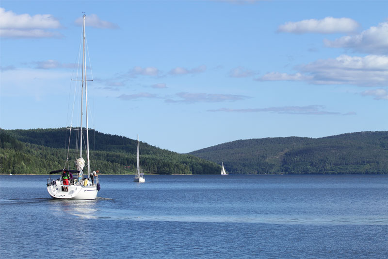
Explore the High Coast on your boat
The Höga Kusten is World Heritage also for sailing