
If you are planning a vacation on the High Coast and you love hiking, Docksta is a great place to start, making it your base camp to explore some of the most stunning trails on the World Heritage site.
Which destinations would I suggest? First, the Skuleskogen National Park and the Skuleberget Mountain Nature Area.
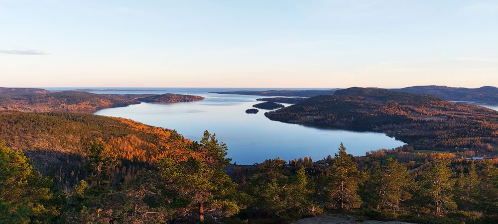
The list of summits is as follows: Skuleberget, Slåttdalsberget at Skuleskogen, Getsvedjeberget, Vårdkallberget, Fäberget, and Herrestaberget. From these mountains, the sweeping views of the archipelago are breathtaking.
They're all well worth the effort, but you'll probably have to decide which to focus on during your excursions. So, the following information may be helpful to you :)

Hiking to the best 6 viewpoints offering sweeping views of the Höga Kusten archipelago
All of these are a few-hour excursions, except for the one to the national park Skuleskogen where you will do well to devote an entire day.
Generally speaking, I advise you to leave the car parked and point out a few of these stunning mountains' peaks, which you can even reach on foot, starting from Docksta.
•
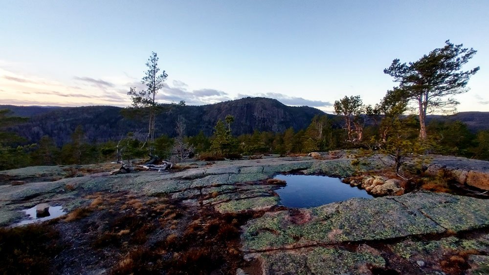
Skuleberget
296m above sea level
You can absolutely not miss the Skuleberget mountain; there are five gorgeous trails to reach its summit.
At the top, the circular path marked with red dots and named Kalottstigen allows you to walk, at 286m a.s.l., along the anchient coastline (it is the world’s highest point of land to have been uplifted by a postglacial isostatic rebound). Here you will enjoy some of the best overview points of the High Coast World Heritage.


It is a short walk or bike ride from the Docksta marina to the base of the mountain, which is less than two kilometers away.

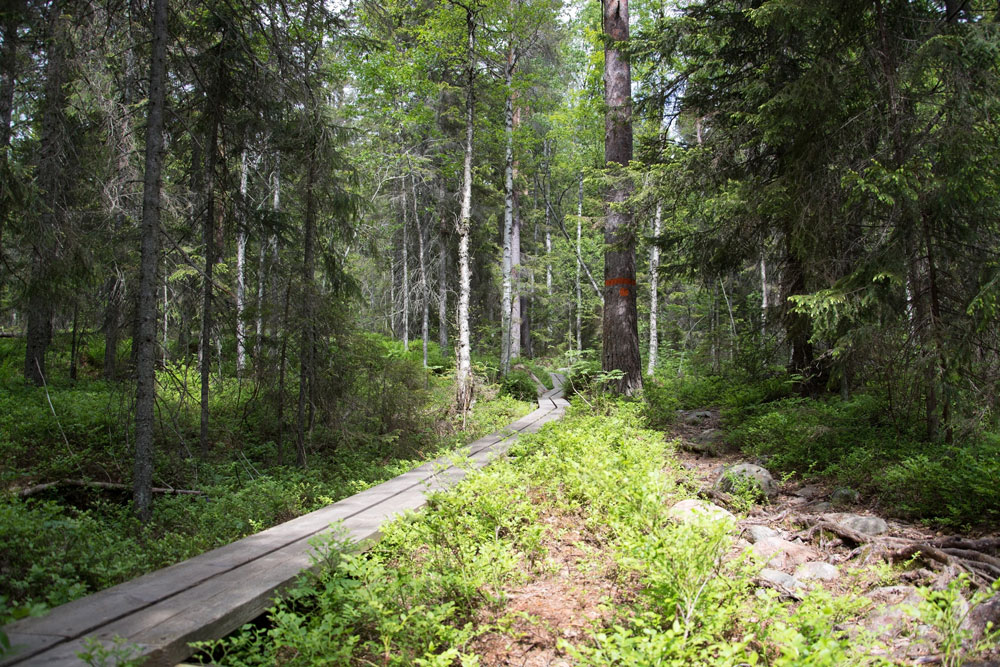
I suggest you go up the east side, where there are the Naturum Museum and the Via Ferrata, because from there two unforgettable paths start: the "Eagle" (Grottstigen) and the "Lynx" (Östra Bergstigen).
The first begins just besides the museum; it is the steepest and takes you on top in just over 800m. The view towards the sea is incredible. It is a challenging path; at some points you will find iron steps in the rock, you will have to walk on large massifs, and you will also have to use your hands. It's not a climb, of course, but I don't recommend it if the ground is wet, just as I'd avoid going through it to get down.
The second option starts just under a kilometer north of the museum, following the Höga Kusten Leden. It climbs up the mountain through the beautiful forests of the natural area and, turning around the north side, offers a couple of truly unique sights, eastward and then towards the national park.
To return, I recommend following downhill the Höga Kusten Stigen / Södra Bergstigen Stigen (the #BIG5 path named “FOX”).
This panoramic path is facing south and 2.5 km long; crossing the summit of Litoberget Mountain brings you back to the valley along the sunny side of the mountain and its stunning panoramas over the Dockstafjärden and Norrfjärden.
Here you find more detailed descriptions of all the trails of the Skuleberget mountain, and the history of the path nicknames inspired by the wild animals of the area.


•
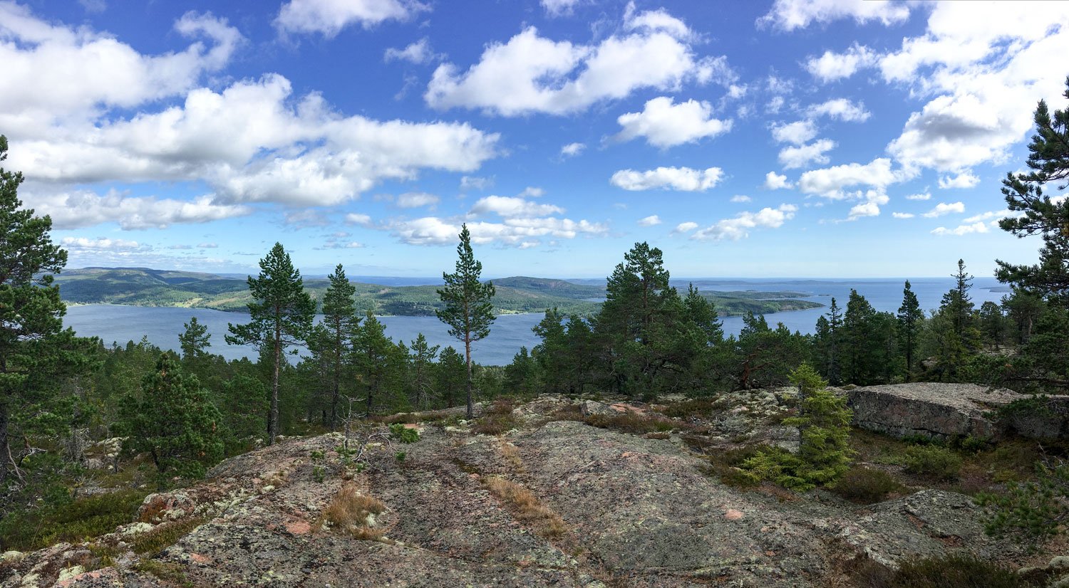
Slåttdalsberget
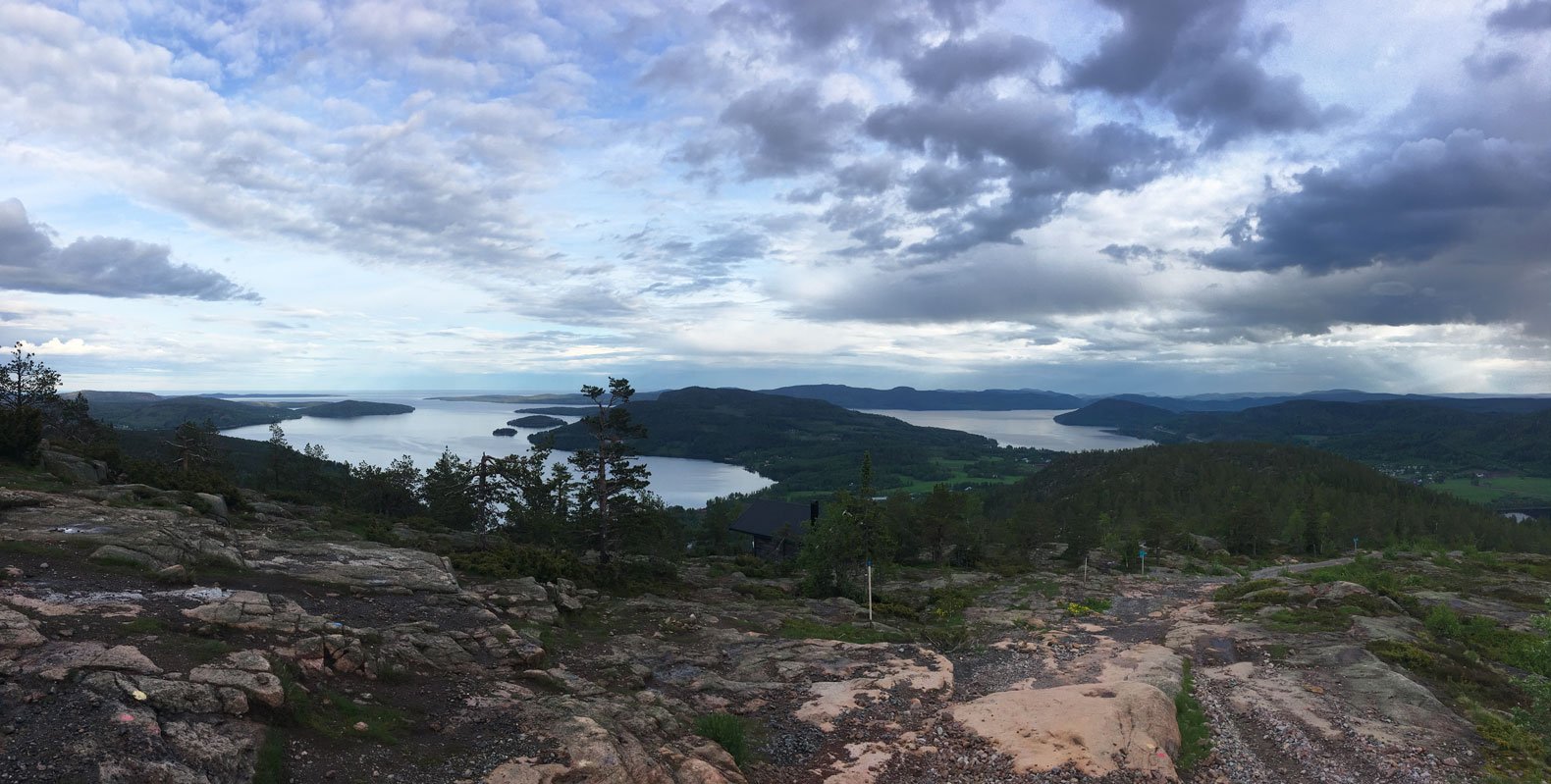
at 276m a.s.l, spanning between the archipelago and the horizons on the National Park


Since 2023, an unprecedented perspective has been opened towards the archipelago from the top of the mountain Slåttdalsberget. Its top, a basically flat “terrace” of red granite rock, where the vegetation is very scarce, can now be traveled along the path from both sides of the mountain that is split in half by the Slåttdalsskrevan, a 200-meter-long and 30-meter-high fissure.

•
Getsvedjeberget
Overlooking the Norrfjärden


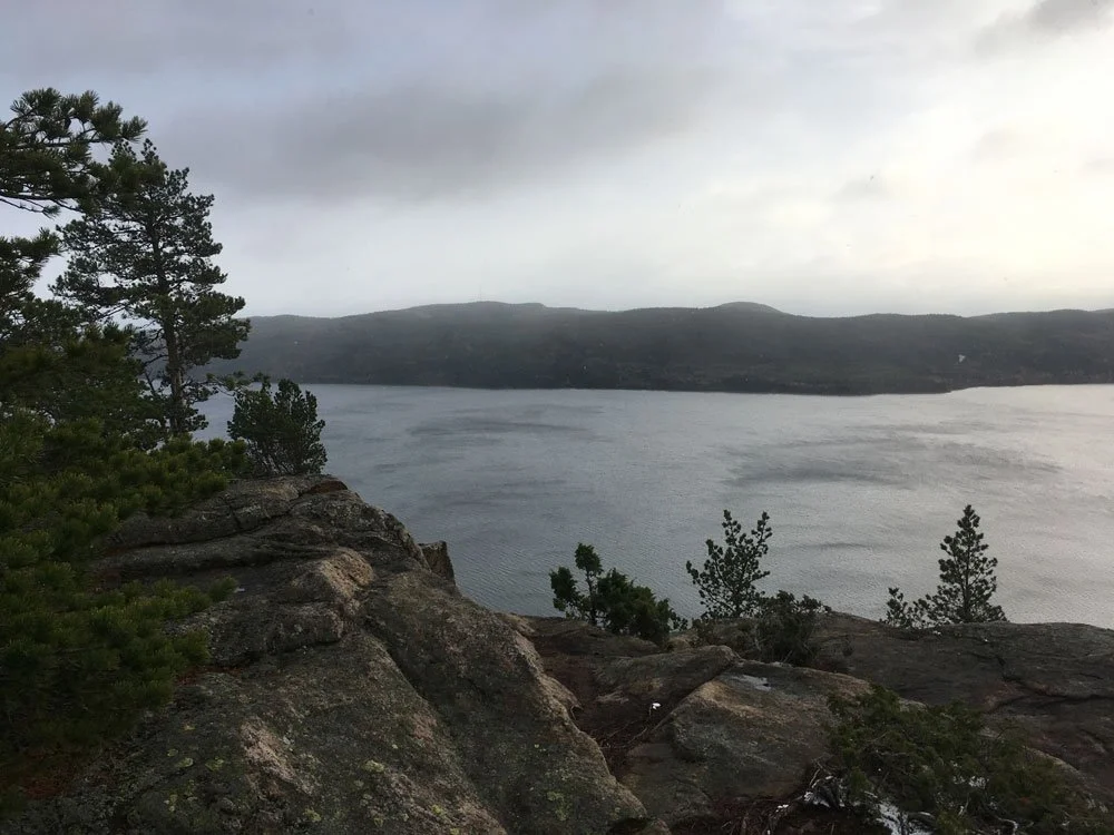
The one that leads to the top of Getsvedjeberget mountain is a short excursion marked by satisfaction, although a bit challenging.
The segment that leads up begins steep and continues to be, but the effort is abundantly rewarded by the beauty it offers on the landscape of the fjord and the surrounding mountains. If you go there on a sunny, windy day, your jaw will drop in astonishment.
From Docksta, you can go there walking or biking (~3km); there is a pleasant road that leads to the Norrfjärden, avoiding crossing the highway. The path starts right inside the campsite.

•
Vårdkallberget
360 degrees views over the wild + the joy to walk the 2.5Km single track segment to the peak
Hiking in the stunning scenery of the High Coast can be experienced firsthand on this delightful and simple trail.
No component is left out. The path, almost a single track between blueberry bushes, slides quietly along the back of the mountain, crossing a beautiful rocky pine forest, where light easily penetrates. The contact with the sky is constant.


From the antenna, in Myre, you reach the summit at 265m a.s.l. in less than 3 kilometers, crossing wet areas, stretched on rocks covered with lichens and surrounded by very ancient pines, contoured by the wind. The path runs through a hidden and almost "secret" lake and crosses in a couple of points some of the typical cobble fields with round stones formed by the waves and sea ice around 10.000 years ago.
From the village, you can walk or bike to Myre to the “Antenna”, and start there your trail to Vårdkallberget: here you can download a free info-map about >
•
Herrestaberget
A special and privileged observation spot

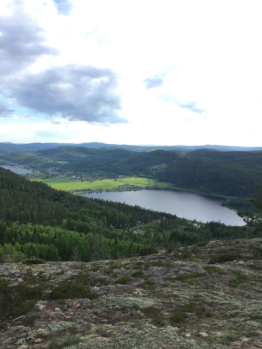
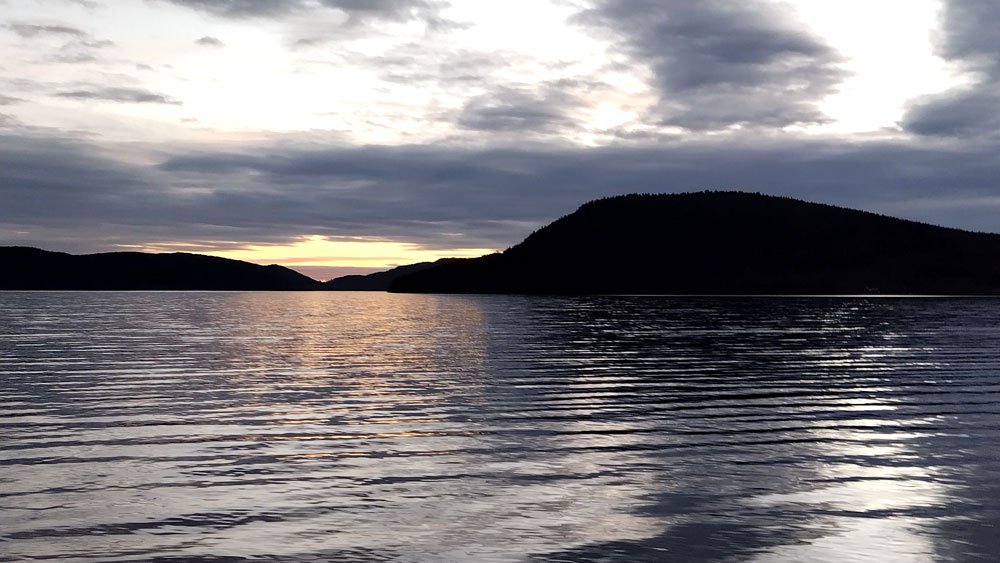
This mountain protects Docksta and the northern part of the fjord from strong western winds coming from Norway.
From the main street of the village, you can hardly see but the Herrestaberget Mountain is there, at less than 1km; it rises in all its natural beauty, enclosing the precious treasure of a small natural area that preserves a portion of its oldest forest heritage from woodcuts.
The trail begins along the southwestern shore of Lake Gällstasjön; in this case, the track does not lead to the summit of the mountain but reaches a beautiful promontory overlooking the southeast. An observation point over Docksta, its fjords, and mountain reliefs will easily stay in your heart.
From the road that coasts the lake, you get there by a steep path in the woods, a little more than 500 meters and an oscillating divide of 129 meters.
From this panoramic point, the trail descends back and forth by taking a wide anti-clock tour around the mountain, leading to Sätra, with the wonderful old 1400 church of the village and the charming fields overlooking the south towards the fjord.

•
Fäberget
At the top of the mountain carved by ice and the sea


From its summit, there is an observation point with an incredible perspective. The mountain sits on the water at the intersection between Dockstafjärden and Ullångerfjärden. It is a cult deviation for all hikers walking along Stage No. 5 of the Höga Kusten Leden.
From the old church in Docksta, the trail crosses the Sätra meadows and enters, after a few hundred meters, into the forest. It is a really suitable walk for everyone, along a beautiful segment of the Höga Kusten Leden. At Skoved, you can safely cross the highway and walk the road toward the mountain and its shelter, facing east over the sea. Make time to explore the few small tracks around the summit toward the north, too. The peak has large, flat rocks covered by lychens and small trees.


During your walk to Fäberget, the short deviation to the shelter of “Per Olsbo” is unmissable.


This spot is a magical place, with a spectacular peak view of the fjord and Vårdkallberget, towards Docksta and the Skuleberget mountain.
Don’t miss to download the free info-map of Per Olsbo’s Shelter >
Along the Höga Kusten Leden, it is marked with the "Utsight" sign approximately a few kilometers south of the church. Remember to sign the guestbook :)
Some tips to prepare your excursions
Move with a light backpack, always carry a reservoir of water with you and something to eat to replenish your energies.
With few exceptions, all the paths that lead you to climb or descend on the reliefs are very technical, you will also walk on rocks, roots and pebbles, you need suitable shoes. You do not need heavy or rigid shoes, good shoes are enough, for example for hiking or trail running, that are comfortable, with a good grip and possibly tasselled.
The paths that I have described are average well marked, you will generally find signs with the indications that are needed or more easily than signs made with colored paint on rocks and trees.
Bring a cell phone with the batteries charged but remember that you will not always have the coverage guaranteed, especially if you are in roaming with a non-Swedish telephone contract.


Tommaso De Rosa
See my host profile and contact me on Airbnb
If you would like assistance planning your stay in one of our waterfront accommodations at the marina, need hiking advice at Skyleskogen Park or Mount Skuleberget, or have any other questions regarding things to do on the High Coast during the summer, please contact me via the Airbnb chat. You are welcome :)
_Tommaso
Please write me by email or WhatsApp at +46.763136909