
If you love sailing + walking, biking, hiking, running or climbing, the marina in Docksta is the perfect base camp to start from.
Head for the best activities & outdoor experiences in the area of Skuleberget natural reserve and Skuleskogen National Park

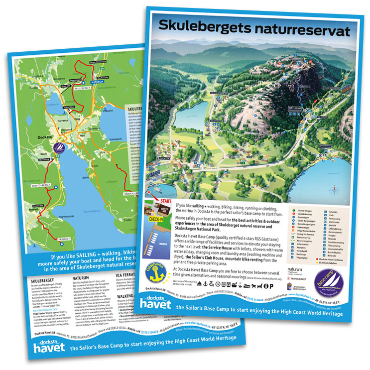
SKULEBERGET
The mountain rises 295 mt above the sea. On the top of Skuleberget you find the highest shoreline in the World - 286 mt above the current coastline, there is a metal band nailed to the rock to mark it. The land uplift continues and is current 8 millimeters a year (and when Skuleberget has rose further 14 meters will it be in the same level as before the ice age 9500 years ago).
Several paths, that you can easily reach walking or biking from your mooring in Docksta, deliver you to the top of the mountain.

Höga Kusten Stigen (58" video)
HIGH COAST SAILOR'S TIPS: Höga Kusten Stigen, opened in 2017, is a well-marked 2,5 km path within Skuleberget natural area to reach the peak: you pass several fantastic views where you can look out over the coast and the mountain's rocky profile. The path starts from FriluftsByn "the Outdoor Village", on the south side of the mountain. Pics, info & free map >

NATURUM MUSEUM
Introducing High Coast's story, and the network of heritage site throughout the coast, the Naturum Höga Kusten Museum is the starting point for anyone who wants to know more about the elevation of the land, which was the reason behind it's nomination as a World Heritage site. There are permanent and temporary exhibitions at all times, plus other activities during the spring/summer season. The exhibit, which examines the land uplift, the geology and the life on the High Coast, takes a modern and playful approach with special information bars where visitors can learn about the many themes. There is a reception with helpful people, a study room, a workshop and a café. There is also a lecture hall, where visitors can watch films, and a library with literature related to Nature and the High Coast. The total exhibit area is 375 square meters and the approach is family friendly. Info (in Swedish) at Naturum website >
Naturum is one of the opportunities that sailors can easily reach: it lies at the foot of the Skuleberget, at the border of the Skuleskogen National Park, about 3 km walking or biking north of Docksta Havet.
VIA FERRATA
Close to the High Coast Visitor's Center (Naturum), on the steep east face of the Skuleberget mountain, there are four climbing path, of different degrees of difficulty, where you climb whilst secured by steel cable. More info about paths & prices at the Via Ferrata website >

THE NATIONAL PARK
If you want your crew to have an unforgettable experience, the Skuleskogen National Park will deliver: a roadless wilderness of 30 square kilometers where the Baltic Coast is at its steepest. Skuleskogen is one of the few remaining large, ancient forests of the coastal region. The red-coloured Nordingrå granite cliffs, the land uplift coast and the coniferous forest, with rare species of lichens, characterise the park.
Main attractions are:
Hiking on over 30 kilometers of well-marked paths of varying degrees of difficulty lead you to everything worth seeing, within forests, hills, bays.
The spectacular views over the national park's dramatic landscape and the surrounding High Coast.
The 7 meter wide, 30 meter deep "Hell Gab" crevice, which cleaves the Slåttdal mountain in two.
More info at the national park's website >
HIGH COAST SAILOR'S TIPS: the southern entrance (Entré Syd) is the nearest to the Slåttdal crevice. Follow the path to Slåttdalsskrevan and climb the Slåttdalsberget to the north of the ravine. You can return back via Tärnättvattnen and Näskebodarna.
Free download the map of the Skuleskogen National Park (.pdf) >
Hiking #fromthepier
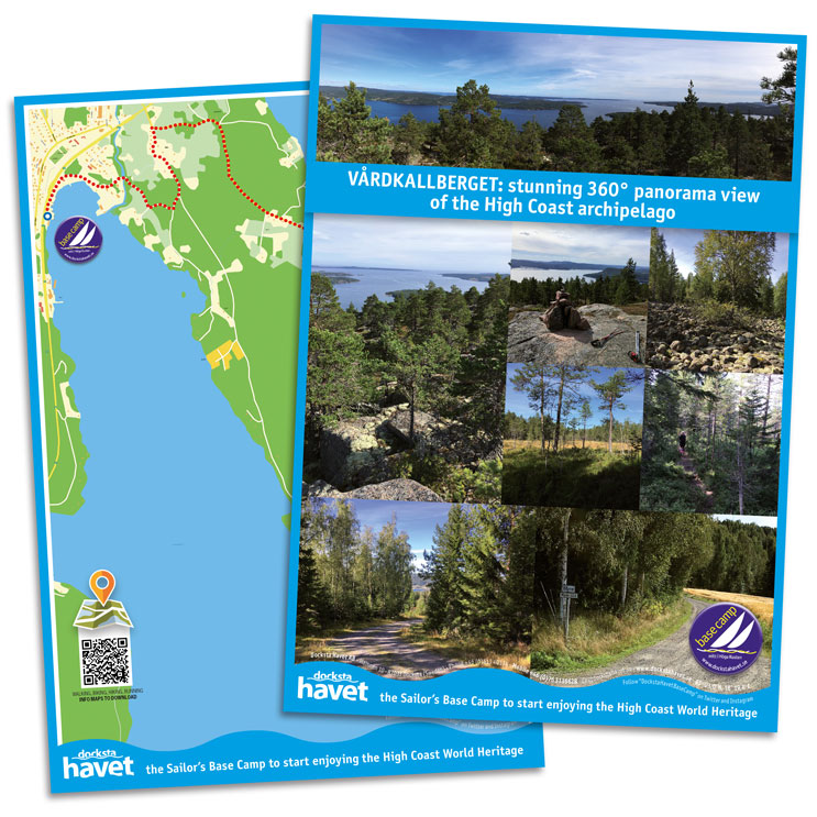
Discover 3 of the most gorgeous scenic peaks in the High Coast

View from the top of Vårdkallberget, Höga Kusten toward Ullångersfjärden and Salsåker.
“Höga Kusten Stigen”

THE SUNNY PATH WITH SEA VIEWS (opened in 2017) to the top of SKULEBERGET (295m a.s.l.)

Vårdkallberget

VÅRDKALLBERGET (264m a.s.l.): 360° PANORAMA OF THE HIGH COAST ARCHIPELAGO

“Per Olsbo” shelter

SKOVEDSBERGET: SHORT WALK IN THE FOREST TO A MAGIC SHELTER OVER THE DOCKSTAFJÄRDEN


[FREE INFO MAPS]
Start discovering Docksta, Skuleberget and Skuleskogen national park #fromthepier


If you love listening, dancing or enjoy great outdoors #fromthepier

High Coast Sailors like:
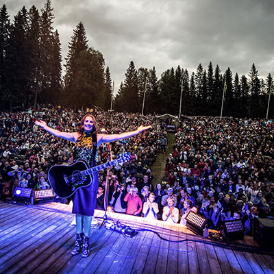
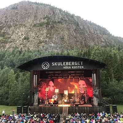
SKULEFESTIVALEN & SKULE NATURSCEN

High Coast Sailors like:
FRILUFTSBYN & TOPPSTUGAN

High Coast Sailors like:
SWEDISH DANCE AT KUSTLADAN